Finsthwaite Heights
Colton, CumbriaCumbria geography stubsFells of the Lake District

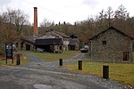
Finsthwaite Heights is an upland area in the English Lake District, above Finsthwaite, Cumbria. It is the subject of a chapter of Wainwright's book The Outlying Fells of Lakeland. It reaches about 600 feet (180 m). Wainwright's walk starts from Newby Bridge, climbs through woodland passing a tower which has a 1799 inscription commemorating the Royal Navy, passes through the village, and climbs to the man-made tarns of Low Dam and High Dam. These were made to provide power for Stott Park Bobbin Mill. Wainwright says of his route: "Everywhere the surroundings are delightful. But this is not fellwalking."
Excerpt from the Wikipedia article Finsthwaite Heights (License: CC BY-SA 3.0, Authors, Images).Finsthwaite Heights
South Lakeland Colton
Geographical coordinates (GPS) Address Nearby Places Show on map
Geographical coordinates (GPS)
| Latitude | Longitude |
|---|---|
| N 54.286666666667 ° | E -2.9822222222222 ° |
Address
Colton
South Lakeland, Colton
England, United Kingdom
Open on Google Maps


