Camel Trail
Cycleways in CornwallFootpaths in CornwallGeographic coordinate listsLists of coordinatesLong-distance footpaths in England ... and 4 more
Rail trails in EnglandRailway lines closed in 1983Railway lines opened in 1831Use British English from March 2017

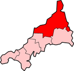
The Camel Trail is a permissive cycleway in Cornwall, England, United Kingdom, that provides a recreational route for walkers, runners, cyclists and horse riders. The trail is flat (and suitable for disabled access); running from Padstow to Wenford Bridge via Wadebridge and Bodmin, it is 17.3 miles (27.8 km) long and used by an estimated 400,000 users each year generating an income of approximately £3 million a year.The trail is managed and maintained by Cornwall Council.
Excerpt from the Wikipedia article Camel Trail (License: CC BY-SA 3.0, Authors, Images).Camel Trail
Camel Trail,
Geographical coordinates (GPS) Address Nearby Places Show on map
Geographical coordinates (GPS)
| Latitude | Longitude |
|---|---|
| N 50.5056 ° | E -4.8171 ° |
Address
Camel Trail
Camel Trail
PL27 6HS , St. Breock
England, United Kingdom
Open on Google Maps


