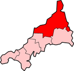
River Allen, Cornwall
Camel catchmentCornish KillasCornwall geography stubsEngland river stubsRivers of Cornwall

The River Allen (Cornish: Dowr Lehen, meaning slate river) in north Cornwall is one of two rivers in Cornwall which share this name. In this case the name is the result of a mistake made in 1888 by Ordnance Survey, replacing the name Layne with Allen which is the old name for the lower reaches of the Camel. The other River Allen runs through Truro. The River Allen is a major tributary of the River Camel. It springs northeast of Camelford and flows south-southwest through the Allen Valley passing St Teath and St Kew Highway to join the Camel near Sladesbridge.
Excerpt from the Wikipedia article River Allen, Cornwall (License: CC BY-SA 3.0, Authors, Images).River Allen, Cornwall
Camel Trail,
Geographical coordinates (GPS) Address Nearby Places Show on map
Geographical coordinates (GPS)
| Latitude | Longitude |
|---|---|
| N 50.5091 ° | E -4.8187 ° |
Address
Camel Trail
Camel Trail
PL27 6HS , St. Breock
England, United Kingdom
Open on Google Maps


