Ball, Cornwall
Hamlets in CornwallNorth Cornwall geography stubs
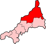
Ball (Cornish: Pelen) is a hamlet on the outskirts of Wadebridge in north Cornwall, England, United Kingdom.The hamlet lies on a loop off the A39 road about 1 mile east of the town centre at grid reference SX 002 731 and lends its name to the roundabout at the east end of the Wadebridge bypass.
Excerpt from the Wikipedia article Ball, Cornwall (License: CC BY-SA 3.0, Authors).Ball, Cornwall
Geographical coordinates (GPS) Address Nearby Places Show on map
Geographical coordinates (GPS)
| Latitude | Longitude |
|---|---|
| N 50.5242 ° | E -4.8196 ° |
Address
PL27 6EE , Egloshayle
England, United Kingdom
Open on Google Maps


