Nassau Street (Winnipeg)
Fort Rouge, WinnipegManitoba road stubsStreets and squares in Winnipeg

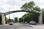
Nassau Street is a 2-kilometre (1.2 mi) street in Winnipeg, Manitoba, located partially within the Osborne Village and Fort Rouge neighbourhoods. The north terminus of Nassau St. North is Roslyn Crescent and travels in a southeast direction, crossing Pembina Highway, swinging southwest before joining up with Garwood Avenue. Its route length is 1.3 km (0.81 mi) The north terminus of Nassau St. South is Brandon Avenue and travels in a southeast direction ending near Churchill Drive with a break near Kylemore Avenue. Its route length is 700 m (0.43 mi).
Excerpt from the Wikipedia article Nassau Street (Winnipeg) (License: CC BY-SA 3.0, Authors, Images).Nassau Street (Winnipeg)
Nassau Street South, Winnipeg Fort Rouge–East Fort Garry
Geographical coordinates (GPS) Address Nearby Places Show on map
 Continue reading on Wikipedia
 Geographical coordinates (GPS)
| Latitude | Longitude |
|---|---|
| N 49.865 ° | E -97.139 ° |
Address
Nassau Street South
Nassau Street South
R3L 2B3 Winnipeg, Fort Rouge–East Fort Garry
Manitoba, Canada
Open on Google Maps