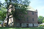
Carvins Cove Natural Reserve
Landforms of Botetourt County, VirginiaLandforms of Roanoke County, VirginiaNature reserves in VirginiaParks in Botetourt County, VirginiaParks in Roanoke County, Virginia ... and 5 more
Regional parks in VirginiaReservoirs in VirginiaRoanoke, VirginiaShenandoah Valley, Virginia geography stubsVirginia municipal and county parks
Carvins Cove Natural Reserve is a 12,700-acre (51 km2) city park in Botetourt and Roanoke counties, Virginia. Managed by the Western Virginia Water Authority and the City of Roanoke, it is the fifth-largest city park in the United States, and the second-largest city park managed by a municipality. Within the park's boundary is Carvins Cove Reservoir and also the main ridgeline of Brushy Mountain, which rises about 1200 feet above the lake's waterline.
Excerpt from the Wikipedia article Carvins Cove Natural Reserve (License: CC BY-SA 3.0, Authors).Carvins Cove Natural Reserve
Tinker Creek Greenway,
Geographical coordinates (GPS) Address Nearby Places Show on map
Geographical coordinates (GPS)
| Latitude | Longitude |
|---|---|
| N 37.38659 ° | E -79.949752 ° |
Address
Tinker Creek Greenway
24020
Virginia, United States
Open on Google Maps

