Whitfield, Northumberland
Former civil parishes in NorthumberlandNorthumberland geography stubsUse British English from August 2019Villages in NorthumberlandWhitfield family

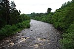
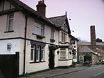
Whitfield is a village and former civil parish, now in the parish of Plenmeller with Whitfield, in the county of Northumberland, England about 10 miles (16 km) southwest of Hexham. It has a farming community and is set against a beautiful scenic background; sometimes it has been called Little Switzerland. In 1951 the parish had a population of 233. The village lies on the River West Allen which joins with the River East Allen less than a mile away to form the River Allen. The village is serviced with a village shop, pub, school and two churches.
Excerpt from the Wikipedia article Whitfield, Northumberland (License: CC BY-SA 3.0, Authors, Images).Whitfield, Northumberland
Geographical coordinates (GPS) Address Nearby Places Show on map
Geographical coordinates (GPS)
| Latitude | Longitude |
|---|---|
| N 54.92 ° | E -2.349 ° |
Address
NE47 8JN , Plenmeller with Whitfield
England, United Kingdom
Open on Google Maps


