place

Wincobank (hill fort)

Buildings and structures in SheffieldHill forts in South YorkshireHills and edges of South YorkshireHistory of SheffieldScheduled monuments in South Yorkshire
Use British English from March 2020
Wincobank Hill Fort geograph.org.uk 1208875

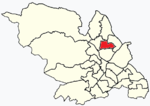
Wincobank (grid reference SK377910) is an Iron Age hill fort near Wincobank in Sheffield, England.

Excerpt from the Wikipedia article Wincobank (hill fort) (License: CC BY-SA 3.0, Authors, Images).

Wincobank (hill fort)
Sandstone Avenue, Sheffield Wincobank

Geographical coordinates (GPS) Address Nearby Places
placeShow on map

Wikipedia: Wincobank (hill fort)Continue reading on Wikipedia

Geographical coordinates (GPS)

Latitude Longitude
N 53.414645 ° E -1.43198 °
placeShow on map

Address

Sandstone Avenue
S9 1AL Sheffield, Wincobank
England, United Kingdom
mapOpen on Google Maps

Wincobank Hill Fort geograph.org.uk 1208875
Share experience

Nearby Places

St Thomas, Brightside

St Thomas is a former Anglican church in the Brightside area of Sheffield in England which now serves as a circus training school. The Sheffield and Rotherham Railway opened in 1838, and both industry and housing spread along its route through the Lower Don Valley. Despite its booming population, the district of Brightside did not have an Anglican church, the local congregation instead meeting in a licensed room with a capacity of only seventy people. However, the district had two large Methodist chapels, and the Church Commissioners supported the construction of an Anglican church with a grant of £100. The total cost of construction was £1600, with the remainder being raised by subscription.A site of around one acre off Holywell Road was donated by the Earl Fitzwilliam, and construction began in 1852, Canon Blackburn laying the foundations stone. It was completed the following year, with consecration by the Archbishop of York, Thomas Musgrave, taking place in 1854. It was designed by Flockton & Son, local architects who had already designed many buildings in Sheffield, including Christ Church, Pitsmoor, and the Anglican Chapel at the Sheffield General Cemetery. In the Gothic revival style, it has a nave and single south aisle, with a tower and spire at the south-western corner.Initially, the church remained part of the parish of Grimesthorpe, but in 1864, it was given its own parish. In 1873, a memorial was erected to William Mannifield, who had been killed in an accident at the nearby Brightside Colliery.George Pace conducted much work on the church, providing new decorations in 1957, then a new altar, reredos and lectern in the 1960s. It was Grade II listed in 1973, but was closed and deconsecrated in 1979. During the 1980s, it was used as the Sheffield School of Gymnastics, then in 1995 it was restored as part of the TV series Challenge Anneka, to serve as a training centre for Greentop Circus.

Brightside, Sheffield

Brightside is an industrial area of Sheffield, South Yorkshire, England lying on a hill north of Attercliffe and the River Don. Brightside was recorded in the fifteenth century as "Brekesherth", when it was home to some mills. Brightside Bierlow was one of the six original divisions of the township of Sheffield, including all the land in the town north of the Don - reaching as far as the Wicker and Neepsend. The first work on the Sheffield and Rotherham Railway was the opening of a cutting in Brightside in 1837. Brightside railway station was opened along with the line in 1838, but closed in 1995. Now the nearest railway station is in Meadowhall (which geographically is in the Shiregreen and Brightside ward) just south of Wincobank. In the 1830s, the only industry in the village was a forge on the river bank. A guide produced for the opening of the railway described Brightside as being "...much frequented by pleasure parties from Sheffield. On every fine Sabbath especially, the sallow artizan may be seen wending his way thither, to inhale the freshness of the country air, and enjoy the beautiful and extensive prospect which the hill affords. The opening of the railway has not been productive of much benefit to it in this respect. Those who, when performing their peregrinations on foot, were compelled to confine them within a circuit of a mile or two round Sheffield, can now ride to Rotherham for sixpence; and the consequence is, that the publicans of Brightside have the mortification of beholding their quondam customers gliding past their very doors to consign to the pockets of the more fortunate retailers of spirits in a more distant town, those gains which they had been accustomed to calculate upon as theirs."St Thomas' Church opened in 1854, and now serves at the training school for Greentop Circus.By 1860, industries were growing in the area, with steel and cutlery manufacture being the main trades. Industry continued to grow, and by the early 1970s, it was mostly industrial, and home to a major railway marshalling yard.Sheffield Brightside was also the name of one of Sheffield's six Parliamentary constituencies until declining population lead to the formation of the larger Sheffield Brightside and Hillsborough.

Brightside railway station

Brightside railway station is a former railway station in Sheffield, South Yorkshire, England. The station served the communities of Brightside and Wincobank and was situated on the Midland Main Line on Holywell Road, lying between Attercliffe Road and Holmes railway station. Work on the Sheffield and Rotherham Railway commenced in February 1837, with Brightside Cutting being the first structure undertaken. The station opened on 1 November 1838, at the same time as the Sheffield and Rotherham Railway from Wicker station and had two platforms although four tracks went through. The two outside tracks were for freight use whilst the two inside tracks were used by both stopping and express trains. The station was just over 2 miles (3.2 km) north of Sheffield railway station, and 3.5 miles (5.6 km) south of Rotherham. Brightside did not have any goods facilities, however, a goods yard and several sidings were located to the immediate south of the station. Despite the opening of Meadowhall Interchange in 1990, the station remained open until 1995. A limited service had continued in its last three years and the station was closed, but all remaining trains could be caught at Meadowhall.Both platforms remain today albeit stripped of their features and in a bad state of repair; the standard South Yorkshire style bus shelters which had replaced the station buildings by the early 1980s were removed in early 2006. The footbridge remains open a public right of way from Dearne Street to Station Lane, however access to the platforms has been blocked off since the station's closure. Only three lines run through the station site; the line furthest east (the former up slow line towards Sheffield) has been removed.