place

Externsteine

Nature reserves in North Rhine-WestphaliaPages with German IPARock formations of North Rhine-WestphaliaTeutoburg Forest
Externsteine panoramio (10)

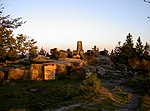
The Externsteine ([ˈɛkstɐnʃtaɪnə]) is a distinctive sandstone rock formation located in the Teutoburg Forest, near the town of Horn-Bad Meinberg in the Lippe district of the German state of North Rhine-Westphalia. The formation is a tor consisting of several tall, narrow columns of rock which rise abruptly from the surrounding wooded hills. In a popular tradition going back to an idea proposed to Hermann Hamelmann in 1564, the Externsteine are identified as a sacred site of the pagan Saxons, and the location of the Irminsul idol reportedly destroyed by Charlemagne; there is however no archaeological evidence that would confirm the site's use during the relevant period. The stones were used as the site of a hermitage in the Middle Ages, and by at least the high medieval period were the site of a Christian chapel. The Externsteine relief is a medieval depiction of the Descent from the Cross. It remains controversial whether the site was already used for Christian worship in the 8th to early 10th centuries.

Excerpt from the Wikipedia article Externsteine (License: CC BY-SA 3.0, Authors, Images).

Externsteine
Externsteiner Straße, Horn-Bad Meinberg

Geographical coordinates (GPS) Address Website Nearby Places
placeShow on map

Wikipedia: ExternsteineContinue reading on Wikipedia

Geographical coordinates (GPS)

Latitude Longitude
N 51.869 ° E 8.9173 °
placeShow on map

Address

Externsteine

Externsteiner Straße
32805 Horn-Bad Meinberg, Horn
North Rhine-Westphalia, Germany
mapOpen on Google Maps

Website
nsg.naturschutzinformationen.nrw.de

linkVisit website

Externsteine panoramio (10)
Share experience

Nearby Places

Ostwestfalen-Lippe
Ostwestfalen-Lippe

Ostwestfalen-Lippe ([ˌɔstvɛstfaːlənˈlɪpə] , literally East(ern) Westphalia-Lippe, abbreviation OWL) is the eastern region of the German state of North Rhine-Westphalia, congruent with the administrative region of Detmold and containing the eastern part of Westphalia, joined with the Lippe region. The region has a population of about two million inhabitants. The major cities are Bielefeld, Paderborn, Gütersloh, Minden, Detmold, and Herford. The highest hill of Ostwestfalen-Lippe is the Totenkopf (498 m). Some major globally operating companies are headquartered in the region, for example Bertelsmann, Miele, Dr. Oetker, Melitta, Gerry Weber, DMG Mori Aktiengesellschaft, Hörmann, Schüco, Wincor Nixdorf, Phoenix Contact, HEGLA and Claas. In 2012 OWL became Germans BMBF Leading Edge Technology Cluster for intelligent Technical Systems (it's OWL ), which is currently the largest public funded project in the context of the government initiative "Industry 4.0". Universities are located in Bielefeld, Paderborn and Lemgo. The Fraunhofer Society is engaged in OWL in Lemgo and Paderborn. The Teutoburg Forest stretches across the region. It is the supposed site of the Battle of the Teutoburg Forest in the year 9 AD, where an alliance of Germanic tribes defeated a Roman army. In 1875, a statue was unveiled of the commander Arminius, who led the Germanics to victory at the battle. This statue, the Hermannsdenkmal, is one of the best-known sights in Ostwestfalen-Lippe.