place

North Norfolk Coast Site of Special Scientific Interest

Archaeology of NorfolkCoastal features of NorfolkMilitary history of NorfolkNature reserves in NorfolkRamsar sites in England
Sites of Special Scientific Interest in Norfolk
Salt marshes geograph.org.uk 205488

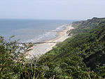
The North Norfolk Coast Site of Special Scientific Interest (SSSI) is an area of European importance for wildlife in Norfolk, England. It comprises 7,700 ha (19,027 acres) of the county's north coast from just west of Holme-next-the-Sea to Kelling, and is additionally protected through Natura 2000, Special Protection Area (SPA) listings; it is also part of the Norfolk Coast Area of Outstanding Natural Beauty (AONB). The North Norfolk Coast is also designated as a wetland of international importance on the Ramsar list and most of it is a Biosphere Reserve. Habitats within the SSSI include reed beds, salt marshes, freshwater lagoons and sand or shingle beaches. The wetlands are important for wildlife, including some scarce breeding birds such as pied avocets, western marsh harriers, Eurasian bitterns and bearded reedlings. The location also attracts migrating birds including vagrant rarities. Ducks and geese winter along this coast in considerable numbers, and several nature reserves provide suitable conditions for water voles, natterjack toads and several scarce plants and invertebrates. The area is archaeologically significant, with artefacts dating back to the Upper Paleolithic. The mound of an Iron Age fort is visible at Holkham, and the site of a 23 ha (57 acres) Roman naval port with a fort built on the castrum pattern is just outside Brancaster. The site of the medieval "chapel" (probably a domestic dwelling) at Blakeney is no longer accessible. Remains of military use from both world wars include an armoured fighting vehicle gunnery range, a hospital and bombing ranges, as well as passive defences such as pillboxes, barbed wire and tank traps. The SSSI is economically important to the area because of the tourists it attracts for birdwatching and other outdoor activities, although sensitive wildlife sites are managed to avoid damage from the large numbers of visitors. Another threat is the encroachment of the sea on this soft coast. The Environment Agency considers that managed retreat is likely to be the long-term solution, and is working with the Norfolk Wildlife Trust to create new reserves inland to compensate for the loss of scarce habitats at the coast.

Excerpt from the Wikipedia article North Norfolk Coast Site of Special Scientific Interest (License: CC BY-SA 3.0, Authors, Images).

North Norfolk Coast Site of Special Scientific Interest
Blakeney Road, North Norfolk Morston

Geographical coordinates (GPS) Address Nearby Places
placeShow on map

Wikipedia: North Norfolk Coast Site of Special Scientific InterestContinue reading on Wikipedia

Geographical coordinates (GPS)

Latitude Longitude
N 52.95 ° E 1 °
placeShow on map

Address

Blakeney Road

Blakeney Road
NR25 7BQ North Norfolk, Morston
England, United Kingdom
mapOpen on Google Maps

Salt marshes geograph.org.uk 205488
Share experience

Nearby Places

St Nicholas, Blakeney

St Nicholas is the Anglican parish church of Blakeney, Norfolk, in the deanery of Holt and the Diocese of Norwich. The church was founded in the 13th century, but the greater part of the church dates from the 15th century when Blakeney was a seaport of some importance. Of the original structure only the chancel has survived rebuilding, perhaps owing to its link to a nearby Carmelite friary. An unusual architectural feature is a second tower, used as a beacon, at the east end (the church stands just inland from, and about 30 metres (98 ft) above, the small port). Other significant features are the vaulted chancel with a stepped seven-light lancet window, and the hammerbeam roof of the nave. St Nicholas is a nationally important building, with a Grade I listing for its exceptional architectural interest. Much of the original church furniture was lost in the Reformation, but a late-Victorian restoration recreated something of the original appearance, as well as repairing and refacing the building. The Victorian woodwork was created to match the few older pieces that remained, or to follow a similar style; thus, the new wooden pulpit follows the themes of the medieval font. Of the stained glass smashed in the Reformation only fragments have been recovered, and these have been incorporated in a window in the north aisle of the church. Nine Arts and Crafts windows by James Powell and Sons are featured on the east and south sides of the church, and the north porch has two modern windows of predominantly blue colour. St Nicholas contains some notable memorials, including several plaques for the Blakeney lifeboats and their crews, and much pre-Reformation graffiti, particularly depictions of ships. The location of the latter suggests that they were votive in nature, although the saint concerned is now unknown.

Blakeney Point
Blakeney Point

Blakeney Point (designated as Blakeney National Nature Reserve) is a national nature reserve situated near to the villages of Blakeney, Morston and Cley next the Sea on the north coast of Norfolk, England. Its main feature is a 6.4 km (4 mi) spit of shingle and sand dunes, but the reserve also includes salt marshes, tidal mudflats and reclaimed farmland. It has been managed by the National Trust since 1912, and lies within the North Norfolk Coast Site of Special Scientific Interest, which is additionally protected through Natura 2000, Special Protection Area (SPA), International Union for Conservation of Nature (IUCN) and Ramsar listings. The reserve is part of both an Area of Outstanding Natural Beauty (AONB), and a World Biosphere Reserve. The Point has been studied for more than a century, following pioneering ecological studies by botanist Francis Wall Oliver and a bird ringing programme initiated by ornithologist Emma Turner. The area has a long history of human occupation; ruins of a medieval monastery and "Blakeney Chapel" (probably a domestic dwelling) are buried in the marshes. The towns sheltered by the shingle spit were once important harbours, but land reclamation schemes starting in the 17th century resulted in the silting up of the river channels. The reserve is important for breeding birds, especially terns, and its location makes it a major site for migrating birds in autumn. Up to 500 seals may gather at the end of the spit, and its sand and shingle hold a number of specialised invertebrates and plants, including the edible samphire, or "sea asparagus". The many visitors who come to birdwatch, sail or for other outdoor recreations are important to the local economy, but the land-based activities jeopardize nesting birds and fragile habitats, especially the dunes. Some access restrictions on humans and dogs help to reduce the adverse effects, and trips to see the seals are usually undertaken by boat. The spit is a dynamic structure, gradually moving towards the coast and extending to the west. Land is lost to the sea as the spit rolls forward. The River Glaven can become blocked by the advancing shingle and cause flooding of Cley village, Cley Marshes nature reserve, and the environmentally important reclaimed grazing pastures, so the river has to be realigned every few decades.