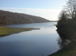
Wharfedale Rural District
Wharfedale was a rural district in the West Riding of Yorkshire from 1894 to 1974. It comprised the northern side of lower Wharfedale, the lower Washburn Valley and several parishes between Leeds and the River Wharfe. Until 1937 it also included a detached part, the parish of Esholt north of Bradford.It contained the following civil parishes: Adel cum Eccup (1894–1928) transferred to County Borough of Leeds Alwoodley (1894–1928) transferred to County Borough of Leeds Arthington Askwith Blubberhouses Bramhope Carlton Castley Denton Esholt (1894–1937) transferred to County Borough of Bradford Farnley Fewston Great Timble Hawksworth (1894–1937) transferred to Aireborough Urban District Leathley Lindley Little Timble Menston (1894–1937) transferred to Aireborough Urban District Middleton Nesfield with Langbar Newell with Clifton Norwood Pool Stainburn WestonIt was abolished in 1974 under the Local Government Act 1972, and split between two new districts. The parishes of Arthington, Bramhope, Carlton and Pool went to the metropolitan district of the City of Leeds in West Yorkshire, with the rest becoming part of the Borough of Harrogate in North Yorkshire.
Excerpt from the Wikipedia article Wharfedale Rural District (License: CC BY-SA 3.0, Authors).Wharfedale Rural District
Geographical coordinates (GPS) Address Nearby Places Show on map
Geographical coordinates (GPS)
| Latitude | Longitude |
|---|---|
| N 53.957 ° | E -1.652 ° |
Address
HG3 1QX
England, United Kingdom
Open on Google Maps


