place

Blaenplwyf transmitting station

Buildings and structures in CeredigionTransmitter sites in Wales
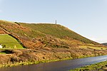
Blaenplwyf TV Transmitter geograph.org.uk 18862

The Blaenplwyf transmitting station (sometimes written "Blaen Plwyf" or "Blaen-Plwyf") is a broadcasting and telecommunications facility located near the village of Blaenplwyf about 10 kilometres (6 mi) to the south west of the town of Aberystwyth, in Ceredigion, Wales (grid reference SN569756). It was originally built by the BBC, entering service in October 1956 acting as a main transmitter for BBC Band II VHF FM radio. It had been planned that the BBC's 405-line VHF television service would commence on the same date, but delays at Rowridge caused the official switch-on to happen six months later on 29 April 1957. Blaenplwyf was considered a main transmitter for VHF television (despite radiating only 3 kW ERP) as it was fed from a microwave link from Mynydd Pencarreg just south of Lampeter. The facility is now owned and operated by Arqiva. The site has a 152 metres (499 ft) guyed steel lattice mast standing on land that is itself 175 metres (574 ft) above sea level. The television and radio broadcasts were originally designed to cover the majority of the Cardigan Bay coastline, the antennas being designed for maximum ERP to the north and to the south-west. Blaenplwyf became a main transmitter for UHF analogue colour television from 1970 onwards, and was transmitting all three original UHF channels in colour from mid 1973.It currently carries all six UK digital television multiplexes.

Excerpt from the Wikipedia article Blaenplwyf transmitting station (License: CC BY-SA 3.0, Authors, Images).

Blaenplwyf transmitting station
A487,

Geographical coordinates (GPS) Address Nearby Places
placeShow on map

Wikipedia: Blaenplwyf transmitting stationContinue reading on Wikipedia

Geographical coordinates (GPS)

Latitude Longitude
N 52.36 ° E -4.101944 °
placeShow on map

Address

A487
SY23 4DJ
Wales, United Kingdom
mapOpen on Google Maps

Blaenplwyf TV Transmitter geograph.org.uk 18862
Share experience

Nearby Places

Penparcau
Penparcau

Penparcau (Welsh pronunciation: [pɛnˈparkai̯]) is a village and electoral ward in Ceredigion, Wales, situated to the south of Aberystwyth. The original village was a hamlet, but the building of extensive Art Deco style semi-detached social housing from the 1920s on transformed it. It lies in the shadow of the Celtic Iron Age hill fort of Pen Dinas, and between the sea at Tan Y Bwlch beach, the River Ystwyth and the Rheidol. Penparcau has the only UNESCO Biosphere reserve in the Dyfi Biosphere. A section of the Wales Coast Path runs over Tan y Bwlch beach. There is an Anglican church named after the Saint Anne, a Roman Catholic church named after the Welsh Martyrs, which is noted in "Architecture of Wales, Carmarthenshire and Ceredigion" and is home to a Lampedusa Cross, as well as two Methodist chapels and a Quaker meeting house. The recently closed Tollgate pub was named after the original tollgate that stood on the old toll road at the top of Penparcau and is now in St Fagans National History Museum near Cardiff. Penparcau has its own woodland, Coed Geufron run by the Woodland Trust and its own police station. Other amenities have included a post office, two supermarkets, a garage, holiday park and hotel and two fish and chip shops. Until late 2007, it also had its own travel agent. In 2008, Penparcau played a part in the transition town movement in Wales when it hosted the "Alternative Energy and Transport Festival" in Neuadd Goffa, attended by the local MP and mayor. At the bottom of the valley, just below Penparcau, is a Welsh Government office building, designed to house more than 550 staff.