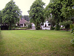
Chadkirk
Geography of the Metropolitan Borough of StockportGreater Manchester geography stubs

Chadkirk is an area in the Metropolitan Borough of Stockport in Greater Manchester, England. It is located between the River Goyt and the Peak Forest Canal south of Romiley, east of the A627 road. The site of a former print works on the right bank of the River Goyt is now occupied by Chadkirk Business Park. Chadkirk Country Estate has been designated as a Local Nature Reserve (LNR). Within it, the ancient woodlands of Kirk Wood and Little Wood have been declared Sites of Biological Importance (SBI).
Excerpt from the Wikipedia article Chadkirk (License: CC BY-SA 3.0, Authors, Images).Chadkirk
Vale Road,
Geographical coordinates (GPS) Address Nearby Places Show on map
Geographical coordinates (GPS)
| Latitude | Longitude |
|---|---|
| N 53.406 ° | E -2.093 ° |
Address
Vale Road
Vale Road
SK6 3LE , Romiley
England, United Kingdom
Open on Google Maps


