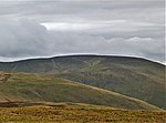
Crown of Scotland (hill)
Dumfries and Galloway geography stubsMountains and hills of Dumfries and GallowayMountains and hills of the Southern UplandsUse British English from October 2013

The Crown of Scotland is a hill in the Scottish Borders, Scotland. At a relatively small elevation from the surrounding peaks, it is situated to the north of the Devil's Beef Tub and the town of Moffat. The hill's unusual name derives from the alliance made between Robert the Bruce and James Douglas, Lord of Douglas upon its summit in 1306, following the former's murder of the Red Comyn at Greyfriars kirk in Dumfries, and when Bruce was on his way to Scone to be crowned by Bishop William de Lamberton.
Excerpt from the Wikipedia article Crown of Scotland (hill) (License: CC BY-SA 3.0, Authors, Images).Crown of Scotland (hill)
Geographical coordinates (GPS) Address Nearby Places Show on map
Geographical coordinates (GPS)
| Latitude | Longitude |
|---|---|
| N 55.38145 ° | E -3.46492 ° |
Address
DG10 9LT
Scotland, United Kingdom
Open on Google Maps


