place

Hockley Brook

England river stubsGeographic coordinate listsLists of coordinatesRivers of the West Midlands (county)Smethwick
Tame catchmentUse British English from March 2017West Midlands (county) geography stubs
Birmingham Spaghetti Junction Hockley Brook and Canal

Hockley Brook is a brook, or stream, in north Birmingham, England. It rises just outside the city, in Smethwick, and runs through Black Patch Park and then through the city's Soho, Hockley and Aston districts, to its confluence with the River Tame, beneath Gravelly Hill Interchange. From there, its waters flow, via the Trent, to the Humber Estuary and the North Sea. At the eastern end, it is known as Aston Brook, giving its name to Aston Brook Street. It previously marked the boundary between Birmingham (then Warwickshire) and Smethwick (then Staffordshire); between the then Staffordshire country villages of Handsworth and Smethwick; and between Birmingham and Aston, before the city absorbed the latter district. The brook once fed several mills and provided water for Matthew Boulton's Soho Manufactory.In post-World War II years, it was culverted (buried in pipes) for much of its length. Local historian and artist Ron "Smudge" Smith titled his 1998 autobiography A Paddle in Hockley Brook.

Excerpt from the Wikipedia article Hockley Brook (License: CC BY-SA 3.0, Authors, Images).

Hockley Brook
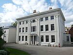
The Crescent, Birmingham

Geographical coordinates (GPS) Address Nearby Places
placeShow on map

Wikipedia: Hockley BrookContinue reading on Wikipedia

Geographical coordinates (GPS)

Latitude Longitude
N 52.496046 ° E -1.919417 °
placeShow on map

Address

The Crescent

The Crescent
B18 5LT Birmingham
England, United Kingdom
mapOpen on Google Maps

Birmingham Spaghetti Junction Hockley Brook and Canal
Share experience

Nearby Places

Icknield Street School

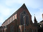
Icknield Street School (grid reference SP057882), near the Hockley Flyover, north of the Jewellery Quarter, Birmingham, England, is a good example of a Birmingham board school. It is owned by Birmingham City Council.Designed in 1883 by J.H. Chamberlain of Martin & Chamberlain, the main architects for the Birmingham School Board, it has been St Chad's Roman Catholic Annexe and is now an Ashram Centre. Standard VII classes for girls began in 1885. However, these classes closed in 1898 at the opening of the George Dixon Higher Grade Board School. In 1886, it was expanded and again so in 1894. It converted into a modern secondary school in 1945 and by 1960, it had 950 pupils. The Chamberlain schools were designed for hygiene, light, fresh air and beauty. Typically in red brick and terracotta, gabled, with steep roofs, free planning and towered to provide ventilation. The tower was typically placed over the staircase to draw air through the school. There were terracotta plaques, glazed tiles, ornamental ironwork, tall windows, and stained glass. The arched roof-supporting ironwork of this school was visible when the roof was missing following a fire. The roof has since been repaired. It is a Grade II* listed building. The headmaster's house (303 Icknield Street), on the site, is separately Grade II* listed. Both are on the English Heritage Heritage at Risk Register, and in December 2021, the pair were included on the Victorian Society's annual "Top Ten Endangered Buildings" list.