Broomhall, Cheshire

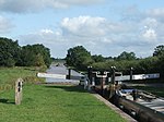
Broomhall is a civil parish in the unitary authority of Cheshire East and the ceremonial county of Cheshire, England. The main line of the Shropshire Union Canal runs through the parish and the River Weaver forms part of its boundary. The main settlement is the hamlet of Broomhall Green, which lies on the A530 about 3.5 miles (5.6 km) south-west of Nantwich. The civil parish has an area of 539 hectares (1,330 acres), and also includes part of the small settlement of Sandford (also in Newhall parish), with a total population of around 200 in 2011. Nearby villages include Aston, Sound, Wrenbury and Audlem. Broomhall appears in the Domesday survey and the name was also historically spelled Bromhall.
Excerpt from the Wikipedia article Broomhall, Cheshire (License: CC BY-SA 3.0, Authors, Images).Broomhall, Cheshire
Cock Lane,
Geographical coordinates (GPS) Address Nearby Places Show on map
Geographical coordinates (GPS)
| Latitude | Longitude |
|---|---|
| N 53.024 ° | E -2.558 ° |
Address
Cock Lane
Cock Lane
CW5 8BY , Broomhall
England, United Kingdom
Open on Google Maps


