Brunnthaler Quellbach

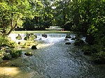
Brunnthaler Quellbach (also: Quellenbach) is a creek of Munich, Bavaria, Germany. Until the end of the 19th century, the Munich river Brunnbach had its source near Bad Brunnthal in the lower Bogenhausen district and, as today, was a tributary of the Isar at St. Emmeran. At the time the Herzogpark was covered with buildings the Brunnbach was filled up north of the street Montgelaßstraße. The former upper course of the Brunnbach in the Maximiliansanlagen park is now a river of its own and is called Brunnthaler Quellbach or Quellenbach. The Brunnthaler Quellbach flows along the street Steinbacherstraße into the small pond Steinbacher Teich, from there a subterranean drainage south of the bridge Max-Joseph-Brücke into the Isar exists.
Excerpt from the Wikipedia article Brunnthaler Quellbach (License: CC BY-SA 3.0, Authors, Images).Brunnthaler Quellbach
Steinbacherstraße, Munich Altbogenhausen (Bogenhausen)
Geographical coordinates (GPS) Address Nearby Places Show on map
Geographical coordinates (GPS)
| Latitude | Longitude |
|---|---|
| N 48.148055555556 ° | E 11.600277777778 ° |
Address
Steinbacherstraße 12
81675 Munich, Altbogenhausen (Bogenhausen)
Bavaria, Germany
Open on Google Maps

