place

Gauangelbach

Baden-Württemberg river stubsRivers of Baden-WürttembergRivers of GermanyTributaries of the Rhine
Schatthausen Gauangelbach

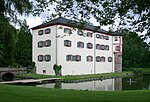
Gauangelbach is a river of Baden-Württemberg, Germany. It flows into the Leimbach in Dielheim. enpferch.[2] It soon emerges from the forest, crosses the Rodungsinsel to the south, intersects the L 600 that runs through it and then follows the edge of the Gauangellocher Teich forest area, before turning south-east through this forest in the direction of Gauangelloch. The Path of the River starts at the edge of the forest on the Untere Weidenklinge district. The water then disappears into a canal and only reappears on the outskirts of Gauangelloch at the Bettendorff moated Gauangelloch castle. After traveling about 1 kilometers south, it reaches the municipal boundary with Schatthausen. Past the moated castle and the village of Schatthausen, the stream turns to the southwest. And at the height of the Hohenhardt golf course, it takes in the Ochsenbach and then the Maisbach from the left. The Gauangelbach reaches the following valley town of Baiertal in the middle of an arc to the west. Below the town its valley runs in a south-westerly direction at the Dielheimer Unterhof to that of the Leimbach. But only after a rest of almost a kilometer in its right floodplain does the Gauangelbach flow into the Leimbach from the right and east, just under half a kilometer before the settlement boundary of Dielheim. The Gauangelbach is 13.3 km long, drains 26.9 km² and has an average bed gradient of 15 ‰.

Excerpt from the Wikipedia article Gauangelbach (License: CC BY-SA 3.0, Authors, Images).

Gauangelbach
L 612, Verwaltungsgemeinschaft Wiesloch

Geographical coordinates (GPS) Address Nearby Places
placeShow on map

Wikipedia: GauangelbachContinue reading on Wikipedia

Geographical coordinates (GPS)

Latitude Longitude
N 49.2831 ° E 8.7499 °
placeShow on map

Address

L 612
69234 Verwaltungsgemeinschaft Wiesloch, Dielheim
Baden-Württemberg, Germany
mapOpen on Google Maps

Schatthausen Gauangelbach
Share experience

Nearby Places

Schwefelquelle Östringen

In the Krummbachwald near Östringen (district of Karlsruhe) there is the enclosed, publicly accessible sulfur spring Östringen, whose water is said to have healing powers and support the immune system. As with the medicinal springs in Bad Mingolsheim and Bad Schönborn, the spring is made up of dissolved, sulfur-containing sodium hydrogen carbonate (Na-HCO3) from the rock (Black Jura). The water comes from the bituminous slate of the Langenbrücken depression. This is the deepest part of the Kraichgaumulde landscape between Ubstadt and Malsch, which extends in an easterly direction to Östringen. When the rock containing pyrites (pyrite) is weathered, the oxidation of the pyrite with subsequent bacterial reduction of the sulfate ion produces hydrogen sulfide (H2S). It gives the mineral water the smell of rotten eggs. In contrast to the healing springs in Bad Schönborn and Bad Mingolsheim, which are pumped from a depth of over 40 °C from a depth of 600 m, the water of the Östringen sulfur spring is cold. It contains 1.5 g / l dissolved substances and 30 mg / l hydrogen sulfide. Visitors who regularly drink from it should note that the daily intake of hydrogen sulfide does not exceed the limit of 100 mg. The well was built in 1960 in the hope of using the medicinal water economically. The dream of Östringen as a spa town "Bad Östringen" failed, however. A sign at the “Am Fischbach” forest car park, next to district road 3521 (Rettigheimer Straße), shows the approx. 400 m long path through the forest. The futuristic design of the fountain and its circular platform in the middle of the closed forest area give the location an extraordinary appearance. Several benches on site invite you to linger. It is advisable to bring a drinking cup with you. Water withdrawal is not possible in the winter months.