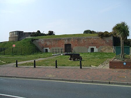
Stokes Bay Lines
Forts in HampshireForts in PortsmouthLists of Palmerston Forts

The Stokes Bay Lines were part of the great Victorian fortification of Portsmouth Harbour under Lord Palmerston. In 1857 Major Jervois had proposed a complex system of moats (ditches), ramparts and batteries to close off the gap between the new fort at Fort Gomer, and the earlier fort at Fort Gilkicker, and Fort Monckton. This defensive moat was to become the ‘Stokes Bay Lines’.
Excerpt from the Wikipedia article Stokes Bay Lines (License: CC BY-SA 3.0, Authors, Images).Stokes Bay Lines
Stokes Bay Road,
Geographical coordinates (GPS) Address Nearby Places Show on map
Geographical coordinates (GPS)
| Latitude | Longitude |
|---|---|
| N 50.783443 ° | E -1.152397 ° |
Address
Stokes Bay Road
Stokes Bay Road
PO12 2LW , Alverstoke
England, United Kingdom
Open on Google Maps


