Glasebacher Teich
Former reservoirsHarz (district)Lower Harz Pond and Ditch SystemSelke basin

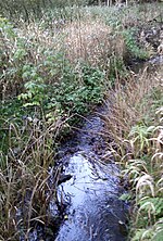
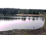
The Glasebacher Teich was an artificial reservoir or Kunstteich laid out near the village of Straßberg in the Harz Mountains of Germany for mining purposes. With a capacity of about 300,000 m³ it was the second largest pond in the Lower Harz. It impounded the Glasebach stream.
Excerpt from the Wikipedia article Glasebacher Teich (License: CC BY-SA 3.0, Authors, Images).Glasebacher Teich
Weidegasse,
Geographical coordinates (GPS) Address Nearby Places Show on map
Geographical coordinates (GPS)
| Latitude | Longitude |
|---|---|
| N 51.609466 ° | E 11.060792 ° |
Address
Grube Glasebach
Weidegasse
06493
Saxony-Anhalt, Germany
Open on Google Maps

