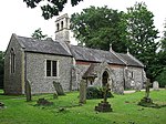
Blofield
BroadlandCivil parishes in NorfolkUse British English from February 2023Villages in Norfolk
Blofield is a village and civil parish in the Broadland district of Norfolk, England. The parish includes Blofield and the hamlets of Blofield Heath and Blofield Corner and, according to the 2001 census, had a population of 3,221, increasing to 3,316 at the 2011 Census. It is on the A47, five miles (8 km) east of Norwich and 14 miles (23 km) west of Great Yarmouth. Since construction of a bypass in 1982, the A47 no longer passes through the village.
Excerpt from the Wikipedia article Blofield (License: CC BY-SA 3.0, Authors).Blofield
North Street, Norwich
Geographical coordinates (GPS) Address Phone number Website Nearby Places Show on map
Geographical coordinates (GPS)
| Latitude | Longitude |
|---|---|
| N 52.635 ° | E 1.448 ° |
Address
Blofield Library
North Street
NR13 4RQ Norwich
England, United Kingdom
Open on Google Maps


