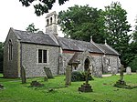
Blofield Heath
BroadlandHamlets in NorfolkNorfolk geography stubs

Blofield Heath is a hamlet in the civil parish of Blofield, in the Broadland district, in the county of Norfolk, England. It is about 7 miles from Norwich. In 2020 it had an estimated population of 1488. Blofield Heath has a post office and Indian restaurant called the Tamarind Blofield, it formerly had a primitive Methodist Chapel. Blofield Heath is separated from Blofield village by the A47.
Excerpt from the Wikipedia article Blofield Heath (License: CC BY-SA 3.0, Authors, Images).Blofield Heath
Francis Lane, Broadland
Geographical coordinates (GPS) Address Nearby Places Show on map
Geographical coordinates (GPS)
| Latitude | Longitude |
|---|---|
| N 52.651865 ° | E 1.4400526 ° |
Address
Francis Lane
Francis Lane
NR13 4SF Broadland
England, United Kingdom
Open on Google Maps


