place

Tetley, Lincolnshire

Borough of North LincolnshireDeserted medieval villages in LincolnshireHamlets in LincolnshireUse British English from December 2013

Tetley is a hamlet, between of the town of Crowle and the village of Ealand, in the North Lincolnshire district of Lincolnshire, England. It is in the civil parish of Crowle and Ealand. The hamlet is considered to be the site of a deserted medieval village and is known to have existed in 1316.Tetley Hall is a Grade II listed building dating from 1829 to 1839 for Henry Lister Maw, although its range is late 18th century, and built for George Stovin. The stables and granary are also Grade II listed.Near Tetley Hall is a limestone font which is perhaps from the mid-17th century, and possibly from the Protestant church in Sandtoft.

Excerpt from the Wikipedia article Tetley, Lincolnshire (License: CC BY-SA 3.0, Authors).

Tetley, Lincolnshire
Park View,

Geographical coordinates (GPS) Address Nearby Places
placeShow on map

Wikipedia: Tetley, LincolnshireContinue reading on Wikipedia

Geographical coordinates (GPS)

Latitude Longitude
N 53.597064 ° E -0.82888 °
placeShow on map

Address

Tetley Hall

Park View
DN17 4HY , Crowle and Ealand
England, United Kingdom
mapOpen on Google Maps

Share experience

Nearby Places

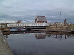
Stainforth and Keadby Canal

The Stainforth and Keadby Canal is a navigable canal in South Yorkshire and Lincolnshire, England. It connects the River Don Navigation at Bramwith to the River Trent at Keadby, by way of Stainforth, Thorne and Ealand, near Crowle. It opened in 1802, passed into the control of the River Don Navigation in 1849, and within a year was controlled by the first of several railway companies. It became part of the Sheffield and South Yorkshire Navigation, an attempt to remove several canals from railway control, in 1895. There were plans to upgrade it to take larger barges and to improve the port facilities at Keadby, but the completion of the New Junction Canal in 1905 made this unnecessary, as Goole could easily be reached and was already a thriving port. The canal was a centre for boatbuilding between 1858, when Richard Dunston moved his yard to Thorne from Torksey, and 1984 when the yard closed. Dunston's company were pioneers in the use of welded construction and innovative tug propulsion systems. The operation was always restricted by the size of Keadby Lock, although vessels longer than the lock could pass through when the river was level with the canal and both sets of gates could be opened. The largest ship to be built required Dunston's to build a dam across the canal, as the canal company feared that it might get stuck in the lock, resulting in flooding and draining of the canal. The canal passes through a region which is largely rural, much of which is drained artificially. For most of its length, it is flanked by the North Soak Drain and the South Soak Drain, because it disrupted the established drainage scheme. Thorne Moors lie to the north and Hatfield Chase lies to the south. Until its demise in 1966, the canal was crossed by the Axholme Joint Railway at Ealand. The swing bridge was retained for several years after closure, so that stators from the nearby Keadby Power Station could be taken away for repairs, as there were no road bridges which could support the weight.