place

Piddletrenthide (liberty)

Dorset geography stubsLiberties of Dorset

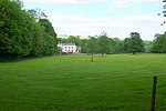
Piddletrenthide Liberty was a liberty in the county of Dorset, England, containing the following parishes: Gorewood (from 1858) Minterne Magna (part) Piddletrenthide

Excerpt from the Wikipedia article Piddletrenthide (liberty) (License: CC BY-SA 3.0, Authors).

Piddletrenthide (liberty)
B3143,

Geographical coordinates (GPS) Address Nearby Places
placeShow on map

Wikipedia: Piddletrenthide (liberty)Continue reading on Wikipedia

Geographical coordinates (GPS)

Latitude Longitude
N 50.7962 ° E -2.4189 °
placeShow on map

Address

B3143
DT2 7QF , Piddletrenthide
England, United Kingdom
mapOpen on Google Maps

Share experience

Nearby Places

Piddlehinton
Piddlehinton

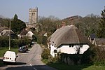
Piddlehinton is a village and civil parish in west Dorset, England, situated in the Piddle valley 5 miles (8.0 km) north of Dorchester. In the 2011 census the parish had a population of 403. Piddlehinton formerly constituted a liberty containing only the parish itself. The local schools are Piddle Valley First School, St Mary's Middle School in Puddletown, The Thomas Hardye School and Dorset Studio School in Dorchester, members of the DASP group. The village has one public house called The Thimble, the village has recently made a shop in the village not far from the Thimble inn public house The nearest shop is in Piddletrenthide. St Mary's Piddlehinton is the local church. A microbrewery—the Dorset Piddle Brewery—was established in Piddlehinton in 2008 and produces 300 gallons of ale every week. During the build-up to D-Day the US Army operated from an airstrip in Piddlehinton using Piper L-4 Grasshoppers of the 62nd Armed Field Artillery Battalion. The exact location of the airstrip in Piddlehinton is unknown. Piddlehinton is at the southern end of the Piddle Valley electoral ward, which extends north up the valley to Buckland Newton and had a population of 1,988 in the 2011 census.Piddlehinton run two adult football teams, which both play in the Dorset Football League. The First XI are in division 2, whilst the reserves are in division 3. The reserves are the current holders of Dorset Division 4, after winning the league in the 2017/2018 season.
Cerne Abbas Giant
Cerne Abbas Giant

The Cerne Abbas Giant is a hill figure near the village of Cerne Abbas, in Dorset, England. It is currently owned by the National Trust, and listed as a scheduled monument of England. Measuring 55 metres (180 ft) in length, the hill figure depicts a bald, nude male with a prominent erection, holding his left hand out to the side and wielding a large club in his right hand. Like many other hill figures, the Cerne Giant is formed by shallow trenches cut into the turf and backfilled with chalk rubble. The origin and age of the figure are unclear, and archaeological evidence suggests that parts of it have been lost, altered, or added, over time; the earliest written record dates to the late 17th century. Early antiquarians associated it, albeit on little evidence, with a Saxon deity, while other scholars sought to identify it with a Romano-British figure of Hercules (or some syncretisation of the two). The lack of earlier descriptions, along with information given to the 18th-century antiquarian John Hutchins, has led some scholars to conclude it dates from the 17th century. Conversely, recent optically stimulated luminescence testing has suggested an origin between the years 700 CE and 1110 CE, possibly close to the 10th-century date of the founding of nearby Cerne Abbey. Regardless of its age, the Cerne Abbas Giant has become an important part of local culture and folklore, which often associates it with fertility. It is one of England's best-known hill figures and is a visitor attraction in the region. The Cerne Giant is one of two major extant human hill figures in England, the other being the Long Man of Wilmington, near Wilmington, East Sussex, which is also a scheduled monument.