place

Piddletrenthide

EngvarB from June 2016Villages in Dorset
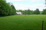
Piddletrenthide geograph.org.uk 388021

Piddletrenthide ( ) is a village and civil parish in the English county of Dorset. It is sited by the small River Piddle in a valley on the dip slope of the Dorset Downs, 8 miles (13 km) north of Dorchester. In the 2011 census the parish—which includes the small village of Plush to the northeast—had 323 dwellings, 290 households and a population of 647.

Excerpt from the Wikipedia article Piddletrenthide (License: CC BY-SA 3.0, Authors, Images).

Piddletrenthide
B3143,

Geographical coordinates (GPS) Address Nearby Places
placeShow on map

Wikipedia: PiddletrenthideContinue reading on Wikipedia

Geographical coordinates (GPS)

Latitude Longitude
N 50.8007 ° E -2.4226 °
placeShow on map

Address

B3143
DT2 7QX , Piddletrenthide
England, United Kingdom
mapOpen on Google Maps

Piddletrenthide geograph.org.uk 388021
Share experience

Nearby Places

Piddlehinton
Piddlehinton

Piddlehinton is a village and civil parish in west Dorset, England, situated in the Piddle valley 5 miles (8.0 km) north of Dorchester. In the 2011 census the parish had a population of 403. Piddlehinton formerly constituted a liberty containing only the parish itself. The local schools are Piddle Valley First School, St Mary's Middle School in Puddletown, The Thomas Hardye School and Dorset Studio School in Dorchester, members of the DASP group. The village has one public house called The Thimble, the village has recently made a shop in the village not far from the Thimble inn public house The nearest shop is in Piddletrenthide. St Mary's Piddlehinton is the local church. A microbrewery—the Dorset Piddle Brewery—was established in Piddlehinton in 2008 and produces 300 gallons of ale every week. During the build-up to D-Day the US Army operated from an airstrip in Piddlehinton using Piper L-4 Grasshoppers of the 62nd Armed Field Artillery Battalion. The exact location of the airstrip in Piddlehinton is unknown. Piddlehinton is at the southern end of the Piddle Valley electoral ward, which extends north up the valley to Buckland Newton and had a population of 1,988 in the 2011 census.Piddlehinton run two adult football teams, which both play in the Dorset Football League. The First XI are in division 2, whilst the reserves are in division 3. The reserves are the current holders of Dorset Division 4, after winning the league in the 2017/2018 season.

Mappowder
Mappowder

Mappowder is a village and civil parish in the county of Dorset in southern England. The parish lies approximately 9 miles (14 kilometres) southeast of the town of Sherborne and covers about 1,900 acres (770 hectares) at an elevation of 75 to 160 metres (250 to 520 feet). It is sited on Corallian limestone soil at the southern edge of the Blackmore Vale, close to the northern scarp face of the Dorset Downs. In the 2011 census the parish had 71 dwellings, 69 households and a population of 166.The village name comes from mapuldor, Old English for 'maple tree'. In 1086 in the Domesday Book Mappowder was recorded as Mapledre and appears in four entries; it was in Buckland Newton Hundred, had 33.3 households and a total taxable value of 8.3 geld units.The church, dedicated to St Peter & St Paul, is Perpendicular and was built in the late 15th and 16th centuries. However, it includes features remaining from an earlier 12th-century church. The chancel was extended in 1868 by the Wingfield Digby family of Sherborne Castle, who owned the village in Victorian times. Mappowder was once the home of the Coker family, who built a large mansion here in 1654, although this was pulled down in the mid-eighteenth century. The building which occupies the site now, Mappowder Court, is mostly of mid-eighteenth-century origin, with some earlier remnants. The stone gateposts at the entrance remain from the original Coker manor; these are topped by carved human heads which in 1905 Sir Frederick Treves described as "Blackamore's" these being "those indefinite natives of the tropics having been used for the crest of the Coker family." In 1559 Henry Coker (c.1528–1596) was member of parliament for the constituency of Shaftesbury. Mappowder Court is listed by English Heritage as Grade II*, with the gateposts and courtyard walls as Grade II.Novelist and short story writer Theodore Francis Powys lived in Mappowder for the last 13 years of his life; he died and was buried here in 1953.