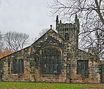
West Yorkshire Built-up Area

The West Yorkshire Built-up Area, previously known as the West Yorkshire Urban Area is a term used by the Office for National Statistics (ONS) to refer to a conurbation in West Yorkshire, England, based on the cities of Leeds, Bradford and Wakefield, and the large towns of Huddersfield and Halifax. It is the 4th largest urban area in the United Kingdom. However, it excludes other towns and villages such as Featherstone, Normanton, Castleford, Pontefract, Hemsworth, Todmorden, Hebden Bridge, Knottingley, Wetherby and Garforth which, though part of the county of West Yorkshire are considered independently. There are substantial areas of agricultural land within the designated area – more than in any other official urban area in England – many of the towns and cities are only just connected with one another by narrow outlying strips of development.
Excerpt from the Wikipedia article West Yorkshire Built-up Area (License: CC BY-SA 3.0, Authors, Images).West Yorkshire Built-up Area
Bradford Road, Kirklees Cross Bank
Geographical coordinates (GPS) Address Nearby Places Show on map
Geographical coordinates (GPS)
| Latitude | Longitude |
|---|---|
| N 53.716666666667 ° | E -1.6333333333333 ° |
Address
Bradford Road
Bradford Road
WF17 5JY Kirklees, Cross Bank
England, United Kingdom
Open on Google Maps


