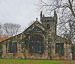
Batley
BatleyGeography of KirkleesHeavy Woollen DistrictOpenDomesdayTowns in West Yorkshire ... and 2 more
Unparished areas in West YorkshireUse British English from February 2014

Batley is a market town in the Metropolitan Borough of Kirklees, in West Yorkshire, England. Batley lies south-west of Leeds, north-west of Wakefield and Dewsbury, south-east of Bradford and north-east of Huddersfield. Batley is part of the Heavy Woollen District. In 2011 the population of Batley including Hanging Heaton, Staincliffe, Carlinghow, Birstall, Birstall Smithies, Copley Hill and Howden Clough was 48,730.
Excerpt from the Wikipedia article Batley (License: CC BY-SA 3.0, Authors, Images).Batley
Stocks Lane, Kirklees Cross Bank
Geographical coordinates (GPS) Address Nearby Places Show on map
Geographical coordinates (GPS)
| Latitude | Longitude |
|---|---|
| N 53.716666666667 ° | E -1.6355555555556 ° |
Address
Stocks Lane
Stocks Lane
WF17 5DH Kirklees, Cross Bank
England, United Kingdom
Open on Google Maps


