place

Dukes Meadows

ChiswickMeadows in Greater LondonParks and open spaces in the London Borough of HounslowParks and open spaces on the River Thames
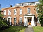
Dukes Meadows 20170616 132037 (32750483997)

Dukes Meadows is a riverside park in Chiswick, London. The land was bought by the council in 1923, and the park was opened in 1926. It is cared for by the Dukes Meadows Trust. The area is home to the Chiswick Farmers' Market, which helps to pay for the park's maintenance. From 2023 the Dukes Meadows Footbridge forms part of the Thames Path.

Excerpt from the Wikipedia article Dukes Meadows (License: CC BY-SA 3.0, Authors, Images).

Dukes Meadows
Barnes Passage, London Grove Park (London Borough of Hounslow)

Geographical coordinates (GPS) Address Nearby Places
placeShow on map

Wikipedia: Dukes MeadowsContinue reading on Wikipedia

Geographical coordinates (GPS)

Latitude Longitude
N 51.4752 ° E -0.2617 °
placeShow on map

Address

Barnes Passage
W4 3HF London, Grove Park (London Borough of Hounslow)
England, United Kingdom
mapOpen on Google Maps

Dukes Meadows 20170616 132037 (32750483997)
Share experience

Nearby Places

Mortlake High Street

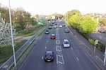
Mortlake High Street is a street running through Mortlake in west London in England, United Kingdom. Located in the London Borough of Richmond, it is the historic high street of Mortlake dating back several centuries. It runs from east to west, beginning at The Terrace, Barnes and running parallel to the southern bank of the River Thames and finishing at Mortlake Green close to Mortlake railway station and the site of the former Mortlake Brewery. It forms part of the A3003 road. Mortlake was celebrated for its tapestry works in the early modern era. The High Street provided the historic centre of the local area, only being overshadowed by the later development of East Sheen a little to the south as the formerly rural area was developed during the urbanisation of London. Mortlake Railway Station opened in 1846 to provide Mortlake with trains to Central London while Barnes Bridge railway station, a little to the east of the high street, opened in 1916 on the Hounslow Loop. The architecture of the street is a mixture of different periods, including Edwardian and later twentieth century apartments alongside buildings such as the Georgian Grade II listed house at 117 Mortlake High Street.The Anglican church St Mary the Virgin is located on the southern side of the street. The current building dates back to the Tudor period, but an earlier chapel existed from 1348. The Prime Minister Henry Addington is buried in the churchyard. The Catholic church St Mary Magdalen is located a little further to the south on Worple Street. Built in 1852 in the Gothic Revival style it features the tomb of Sir Richard Burton, the noted explorer and writer.The house at 123 Mortlake High Street, at the eastern end of the street, was built in 1720. Historic residents have included Lady Byron and the Irish soldier Sir Garnet Wolseley. From 1895 to 1940 it served as the town hall of Borough of Barnes, until it was bombed during the London Blitz of 1940. It was painted in the early nineteenth century by Turner, and is now Grade II* listed.From 1901 to 1959 Barnes power station operated on the High Street. Now decommissioned, the building still stands on the street.

Polytechnic Stadium (London)

The Polytechnic Stadium is a sports venue on Hartington Road, Chiswick, London. It is the centre piece of the Quintin Hogg Memorial Grounds (now known as University of Westminster Sports Grounds).In 1888 Quintin Hogg built a boathouse near Chiswick Bridge, which is used at the finish of the university boat race each year. When Hogg died in 1903, an appeal to raise funds for a memorial in his memory took place. The Quintin and Alice Hogg Memorial was built and a piece of land in Chiswick was purchased. In 1936 plans were drawn up for a sports stadium to be built at the site. The design was undertaken by Joseph Addison, Head of Architecture at Regent Street Polytechnic. The stadium was home to the 'Polytechnic Harriers' athletics club, along with several local clubs and schools. It was also used for international and national competitions as soon as it was built, including the Amateur Athletic Association championships. In 1938 the sports ground was extended for the stadium to be built by 7.5 acres. The grandstand had a capacity of 658 spectators and contained a restaurant on the first floor. In July 1944 the stadium suffered bomb damage with all the windows blown out and the running track damaged. Behind the stand there is a miniature railway.From 1938 until 1973 the Polytechnic Marathon finished at the stadium. In the 1963 edition of the marathon a world record was set at the stadium by Leonard Edelen.Primarily a track and field athletics venue, it hosted the field hockey preliminaries for the 1948 Summer Olympics.The grandstand is now a listed grade 2 protected structure, but is unused due to it not being able to meet modern health and safety criteria.It was the home stadium of rugby league team Fulham RLFC (now the London Broncos) between 1985 and 1990.