place

Seacombe Heights, South Australia

Adelaide geography stubsSuburbs of AdelaideUse Australian English from August 2019

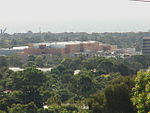
Seacombe Heights is a suburb of Adelaide in the City of Marion. It gets its name from Seacombe on the Wirral Cheshire, where many settlers emigrated from. Area highlights include the Seacombe Heights Tennis Club on Grafton Street, where courts can be hired by the public. Seaview High School is located on a large land parcel within Seacombe Heights and features a large irrigated oval, popular with locals outside of school hours. Many Seacombe Heights locals enjoy nature walks in the O'Halloran Hill Conservation park.

Excerpt from the Wikipedia article Seacombe Heights, South Australia (License: CC BY-SA 3.0, Authors).

Seacombe Heights, South Australia
Karoona Crescent, Adelaide Seacombe Heights

Geographical coordinates (GPS) Address Nearby Places
placeShow on map

Wikipedia: Seacombe Heights, South AustraliaContinue reading on Wikipedia

Geographical coordinates (GPS)

Latitude Longitude
N -35.034 ° E 138.549 °
placeShow on map

Address

Karoona Crescent

Karoona Crescent
5047 Adelaide, Seacombe Heights
South Australia, Australia
mapOpen on Google Maps

Share experience

Nearby Places

Seacliff Park, South Australia

Seacliff Park is a suburb of Adelaide partly in the City of Marion and the City of Holdfast Bay. The suburb is adjacent to South Brighton in the north, Seaview Downs to the east, Hallett Cove to the south, and Marino and Seacliff on its western side. The suburb is divided diagonally by Ocean Road, with the northern part of the suburb mainly residential, and the southern park partly occupied by a golf course and a quarry.Prior to the 1836 British colonisation of South Australia, the area was inhabited by the Kaurna people, who occupied the land from Cape Jervis in the south up the western side of the Fleurieu Peninsula, to Crystal Brook in the north, west to the Mount Lofty Ranges, across to Gulf Saint Vincent, including the Adelaide Plains and city of Adelaide.The Kaurna name for the area was Wita-wattingga, or Wita-wita, was the Kaurna name of an area on the north side of O'Halloran Hill, which was then covered in low woodland of Eucalyptus porosa and/or Eucalyptus odorata known as mallee peppermint gums. The forested area named thus included the north-western slopes at South Brighton and Seaview Downs, across to Seacliff Park, and probably also included the area across the hill nearly as far as the present Main South Road as well as westwards as far as the eastern slopes of Marino. The place name was recorded in 1837 as "Weta wertinga", although its meaning, "in the midst of peppermint gums" was only recorded later. The name may have been a generic name applied to other places with peppermint gums; a similar name, Witawatang, was also applied to an area near Rapid Bay.Seacliff Park Post Office opened on 15 January 1995, replacing the nearby South Brighton office.In the 2016 Australian census, there were 2,439 people living in Seacliff Park.