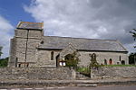
Bawdrip
Civil parishes in SomersetOpenDomesdaySomerset LevelsUse British English from August 2012Villages in Sedgemoor

Bawdrip is a village and civil parish in the Sedgemoor district of Somerset, England. The village is on the south side of the Polden Hills about 4 miles (6.4 km) north-east of Bridgwater. At the 2011 census the parish had a population of 506. The parish includes the hamlets of Bradney, Horsey and Knowle.
Excerpt from the Wikipedia article Bawdrip (License: CC BY-SA 3.0, Authors, Images).Bawdrip
Eastside Lane,
Geographical coordinates (GPS) Address Nearby Places Show on map
Geographical coordinates (GPS)
| Latitude | Longitude |
|---|---|
| N 51.153 ° | E -2.942 ° |
Address
Eastside Lane
Eastside Lane
TA7 8QB , Bawdrip
England, United Kingdom
Open on Google Maps


