Ashford Carbonell
Civil parishes in ShropshireOpenDomesdayVillages in ShropshireWikipedia pending changes protected pages

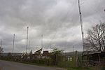
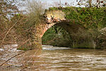
Ashford Carbonell (or Ashford Carbonel) is a village and civil parish in south Shropshire, England, near the county border with Herefordshire. The village lies 2.5 miles (4.0 km) south of the market town of Ludlow, on the eastern side of the River Teme, facing the smaller Ashford Bowdler. The river acts as the boundary between the parishes of Ashford Bowdler and Ashford Carbonel, and is crossed locally by Ashford Bridge, which takes the Caynham Road from the A49 towards Caynham.The civil parish (which is formally named Ashford Carbonel) had a population of 321 as recorded in the 2011 census; the area covered by the parish is 635 hectares (1,570 acres).
Excerpt from the Wikipedia article Ashford Carbonell (License: CC BY-SA 3.0, Authors, Images).Ashford Carbonell
Donkey Lane,
Geographical coordinates (GPS) Address Nearby Places Show on map
Geographical coordinates (GPS)
| Latitude | Longitude |
|---|---|
| N 52.33 ° | E -2.7 ° |
Address
Donkey Lane
SY8 4BZ , Ashford Carbonel
England, United Kingdom
Open on Google Maps


