place

Sheet, Shropshire

LudlowShropshire geography stubsVillages in Shropshire
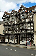
The Sheet. geograph.org.uk 148085

Sheet (or "The Sheet") is a small modern village in the parish of Ludford about 1 mile (1.6 km) from the town centre of Ludlow, Shropshire. It was mentioned in the Domesday Book of 1086. It was part of the Saxon hundred of Culvestan, which ended in the reign of Henry I, and thereafter Sheet belonged to Munslow hundred.The A49 road (the Ludlow by-pass) runs through the area, with a roundabout junction for Sheet Road, an unclassified road which begins at the junction of Lower Galdeford and Weeping Cross Lane in Ludlow, runs through Sheet, and heads out to the village of Caynham. Ludlow's only park and ride (using buses to the town centre) car park site is at Sheet. The Ledwyche Brook flows just to the east.

Excerpt from the Wikipedia article Sheet, Shropshire (License: CC BY-SA 3.0, Authors, Images).

Sheet, Shropshire
Squirrel Court,

Geographical coordinates (GPS) Address Nearby Places
placeShow on map

Wikipedia: Sheet, ShropshireContinue reading on Wikipedia

Geographical coordinates (GPS)

Latitude Longitude
N 52.364 ° E -2.69 °
placeShow on map

Address

Squirrel Court

Squirrel Court
SY8 4JT
England, United Kingdom
mapOpen on Google Maps

The Sheet. geograph.org.uk 148085
Share experience

Nearby Places

Ledwyche Brook
Ledwyche Brook

Ledwyche Brook is a minor river in south Shropshire, England. It is sometimes referred to as the River Ledwyche and spelled variously, including "Ledwich" or "Ledwych". The brook is a tributary of the River Teme. Its sources are just south of Brown Clee Hill, in the vicinity of Stoke St. Milborough, from where it flows southwest to Middleton, after which it turns southwards, passing under the A4117 road at Henley, where it passes by Henley Hall. The B4364 road runs along the Ledwyche valley from its junction with the A4117 to where it runs around Brown Clee Hill.The river avoids the River Teme at Ludlow, running instead to the east of the town, resulting in a peninsula of land one mile 1 mile (1.6 km) wide between the two watercourses, at the Sheet. Ledwyche Brook then flows in a southeast direction, passing through Caynham and afterwards passing to the west of Greete.It finally discharges into the Teme at Burford. Just before its confluence the A456 road bridges the brook. For approximately 3.5 miles (5.6 km) between Caynham and Burford the brook forms the border between the counties of Shropshire and Herefordshire. The tripoint between the counties of Shropshire, Herefordshire and Worcestershire is just upstream of the Teme from the confluence.Two small settlements, separated by some distance, are named after the brook — Upper Ledwyche and Lower Ledwyche; with Ledwyche deriving from a personal name (Leoda) and wīc which means dwelling place.The Elan aqueduct (which carries drinking water to Birmingham from Wales) crosses the Ledwyche just downstream from the Sheet.

Middleton, Bitterley

Middleton is a small village in south Shropshire, England. It is located 2.5 miles (4.0 km) northeast of Ludlow town centre, on the B4364 road (which runs between Ludlow and Bridgnorth), in the civil parish of Bitterley. The settlement existed at the time of the Domesday Book (1086) when it had a mill on the Ledwyche Brook. At the time it formed part of the hundred of Culvestan, which merged into the new hundred of Munslow in the early 12th century. For several hundred years it was known as Middleton Higford after its chief tenant Walter de Huggeford who had his main holding at Higford near Shifnal. Middleton has a Norman chapel, much renovated in the 1850s, with a Norman motte next to it. It is a grade II* listed building.Middleton Court nearby was built in 1864 by the Rouse-Boughton family of Downton Hall who owned most of the land around. Brook House, built in the late 1500s, is a timber-framed moated manor house which is also Grade II* listed. Its late 18th Century privy, 17th and 18th Century outbuilding and kiln and its stables dated 1726 are all Grade II listed. Brook House Cottage (Grade II* listed) is medieval with 17th Century and 19th Century alterations.Middleton was on the now-dismantled railway line from Clee Hill Junction in Ludlow to the quarries on Clee Hill. Most of the present-day village is 20th century and built along the B4364, comprising some older detached properties and three housing developments: Paddockside, Westview and Ledwyche Close.