place

Odenkirchen

Düsseldorf region geography stubsTowns in North Rhine-Westphalia

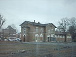
Odenkirchen is a former town in Germany, presently part of the city Mönchengladbach. It is situated on the river Niers, 21 miles by rail south-west of Düsseldorf. It has a railway station (Rheydt-Odenkirchen), on the line from Mönchengladbach to Grevenbroich and Cologne. Pop. (2000) 19,993. Odenkirchen castle was the seat of the lords of Odenkirchen from the 12th century. From 1794 to 1814, Odenkirchen was part of the French Roer département, from 1815 to 1918 part of the Kingdom of Prussia (Province of Jülich-Cleves-Berg, Rhine Province). It was given city rights in 1856. In 1929, it was incorporated into Gladbach-Rheydt, since 1975 part of Mönchengladbach. Odenkirchen remained a separate district within Mönchengladbach until 2009, when it was merged into the larger Mönchengladbach Süd city district. The name Odenkirchen may derive from the Low German for either "wooden church" or "old church". Alternatively it may be from the given name Odo. Odenkirchen was in use as a locational surname from at least the 18th century (anglicized as Odenkirk in the United States from the early 19th century).

Excerpt from the Wikipedia article Odenkirchen (License: CC BY-SA 3.0, Authors).

Odenkirchen
Mongshof, Mönchengladbach Sasserath (Süd)

Geographical coordinates (GPS) Address Nearby Places
placeShow on map

Wikipedia: OdenkirchenContinue reading on Wikipedia

Geographical coordinates (GPS)

Latitude Longitude
N 51.116666666667 ° E 6.45 °
placeShow on map

Address

Mongshof 40
41199 Mönchengladbach, Sasserath (Süd)
North Rhine-Westphalia, Germany
mapOpen on Google Maps

Share experience

Nearby Places

Rheydter Höhe
Rheydter Höhe

The Rheydter Höhe is a Trümmerberg in the Mönchengladbach district of Pongs in the south of the city. Locally the hill, which is made of rubble, is known as Monte Clamotte ("Mount Rubble") or Rheydter Müllberg (the "Rheydt Rubbish Tip"). The plateau of the small hill is 133 m above NN high, making it the highest point in the borough. Measuring 64 m from foot to summit, it is also the highest Trümmerberg in Germany. The Rheydter Höhe ("Rheydt Hill") was created in 1945 from rubble left behind by the bombing of the towns of Mönchengladbach and Rheydt, which left 65% of the two towns in ruins. During the 1950s, great quantities of domestic rubbish were dumped on the Trümmerberg. In order to enable plants and trees to grown, a layer of humus, between one and two metres thick, laid over the household rubbish. During the 1990s, this resulted in poison gas emissions from the rubble, of which nothing can be seen today. However, about 30 metres below the plateau, which doubles as a viewing point, individual pieces of plastic bags can be seen on the sides of the footpath, which have been exposed by rainwater over time. At the northern foot of the Trümmerberg is a water play park, a pond and the Rheydt municipal forest with barbecue sites, a minigolf course, a café and facilities for other activities. The road of Dahlener Straße (one of the main transport axes of the town, linking Rheydt with Rheindahlen) and the A 61 motorway run south and west of the Rheydter Höhe respectively.

Roer (department)
Roer (department)

Roer [ʁo.ɛʁ] was a department of the French First Republic and later First French Empire in present-day Germany and the Netherlands. It was named after the river Roer (Rur), which flows through the department. It was formed in 1797, when the left bank of the Rhine was occupied by the French. The department was formed from the duchies of Jülich and Cleves, the part of the Archbishopric of Cologne left of the Rhine, the Free City of Aachen, the Prussian part of the duchy of Guelders and some smaller territories. In 1805 the city of Wesel was added to the department. The capital was Aix-la-Chapelle (Aachen). The department was subdivided in the following arrondissements and cantons (situation in 1812): Aachen (Aix-la-Chapelle), cantons: Aachen (2 cantons), Burtscheid, Düren, Eschweiler, Froitzheim, Geilenkirchen, Gemünd, Heinsberg, Linnich, Monschau and Sittard. Cleves, cantons: Cleves, Geldern, Goch, Horst, Kalkar, Kranenburg, Wankum, Wesel and Xanten. Krefeld (Crefeld), cantons: Krefeld, Bracht, Erkelenz, Kempen, Moers, Neersen, Neuss, Odenkirchen, Rheinberg, Uerdingen, Viersen Cologne, cantons: Cologne (4 cantons), Bergheim, Brühl, Dormagen, Elsen, Jülich, Kerpen, Lechenich, Weiden and Zülpich.Its population in 1812 was 631,094.After Napoleon was defeated in 1814, the department was divided between the United Kingdom of the Netherlands (left bank of the Meuse and a strip along its right bank including Gennep, Tegelen and Sittard, in present-day Dutch Limburg) and the Kingdom of Prussia (Province of Jülich-Cleves-Berg, now part of North Rhine-Westphalia, Germany).