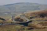
Hartington Upper Quarter
Civil parishes in DerbyshireDerbyshire geography stubs
Hartington Upper Quarter is a civil parish in the High Peak district of Derbyshire, England. The civil parish was created following the division of the ancient parish of Hartington into four. The parish had a population of 451 according to the 2001 census reducing to 438 at the 2011 Census.The parish is long and thin, extending from north-west of Buxton, taking in the Errwood Reservoir, to the south-east, and Ann Croft. The parish borders parishes in High Peak and Derbyshire Dales districts, and also some parishes in the Staffordshire Moorlands and Cheshire East districts.
Excerpt from the Wikipedia article Hartington Upper Quarter (License: CC BY-SA 3.0, Authors).Hartington Upper Quarter
Goyt's Lane, High Peak Hartington Upper Quarter
Geographical coordinates (GPS) Address Website Nearby Places Show on map
Geographical coordinates (GPS)
| Latitude | Longitude |
|---|---|
| N 53.2748 ° | E -1.9767 ° |
Address
Errwood Sailing Club
Goyt's Lane
SK17 6GJ High Peak, Hartington Upper Quarter
England, United Kingdom
Open on Google Maps


