Col de Joux Plane
Cycling stubsHaute-Savoie geography stubsLandforms of Haute-SavoieMountain passes of Auvergne-Rhône-AlpesMountain passes of the Alps ... and 1 more
Transport in Auvergne-Rhône-Alpes

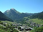
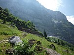
Col de Joux Plane (el. 1691 m.) is a high mountain pass in the Alps in Haute-Savoie, France, linking Morzine with Samoëns. The climb has been featured several times in the Tour de France cycling race
Excerpt from the Wikipedia article Col de Joux Plane (License: CC BY-SA 3.0, Authors, Images).Col de Joux Plane
D 354, Bonneville
Geographical coordinates (GPS) Address Nearby Places Show on map
Geographical coordinates (GPS)
| Latitude | Longitude |
|---|---|
| N 46.132777777778 ° | E 6.7113888888889 ° |
Address
Croisement du Col
D 354
74440 Bonneville
Auvergne-Rhône-Alpes, France
Open on Google Maps


