Devilbend Natural Features Reserve

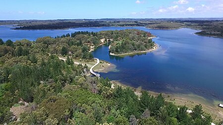
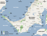
Devilbend Natural Features Reserve is a 1,005 ha (2,480 acres) natural reserve park in the rural locality of Tuerong on the Mornington Peninsula in central southern Victoria, Australia, 55 km (34 mi) southeast of the state capital Melbourne's city center. The park contains two decommissioned water supply reservoirs, the Devilbend Reservoir and Bittern Reservoir, which are less than 600 m (660 yd) apart and linked by an often-dry drainage channel. These reservoirs were the original reason the surrounding parkland was protected from general public access and was not subjected to land development. Both reservoirs are along the course of the eponymous Devilbend Creek, a left tributary of the much larger Balcombe Creek that drains into Port Phillip Bay at Mount Martha. Nearby just 500 m (550 yd) in the north, there is a much smaller, unnamed third lake further downstream along the creek in the neighbouring locality of Moorooduc, next to a golf course within what is known as the Devilbend Recreation Reserve.
Excerpt from the Wikipedia article Devilbend Natural Features Reserve (License: CC BY-SA 3.0, Authors, Images).Devilbend Natural Features Reserve
Daangean Point Track, Melbourne
Geographical coordinates (GPS) Address Nearby Places Show on map
Geographical coordinates (GPS)
| Latitude | Longitude |
|---|---|
| N -38.2876 ° | E 145.1044 ° |
Address
Daangean Point Track
Daangean Point Track
Melbourne
Victoria, Australia
Open on Google Maps


