place

Bay, Springfield, Massachusetts

Neighborhoods in Springfield, Massachusetts

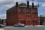
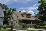
The Bay neighborhood is located in Springfield, Massachusetts. It covers 556.5 acres of land, making it one of the city's smallest neighborhoods.

Excerpt from the Wikipedia article Bay, Springfield, Massachusetts (License: CC BY-SA 3.0, Authors).

Bay, Springfield, Massachusetts
Cortland Street, Springfield

Geographical coordinates (GPS) Address Nearby Places
placeShow on map

Wikipedia: Bay, Springfield, MassachusettsContinue reading on Wikipedia

Geographical coordinates (GPS)

Latitude Longitude
N 42.122 ° E -72.557 °
placeShow on map

Address

Cortland Street 266
01109 Springfield
Massachusetts, United States
mapOpen on Google Maps

Share experience

Nearby Places

New Bay Diner Restaurant

The New Bay Diner Restaurant is a historic diner in Springfield, Massachusetts. It was manufactured by the Mountain View Diners Company in Signac, New Jersey (as #532) in 1957; it is believed to be the second-to-last diner the company built before it shut down later that year. The diner is attached to a concrete block structure which houses the kitchen and restrooms, and appears to also date to 1957. At the time of its listing on the National Register of Historic Places in 2003, it was one of six surviving Mountain View diners in Massachusetts, and the only diner remaining in Springfield.When the diner was listed in Springfield's 1964 business directory, it was called the New Bay Diner Restaurant, and its owner was listed as Anthony Viamare of Granby, Massachusetts. Viamare owned it until 1988, when it was acquired by Donald Roy. He changed its name to the "Route 66 Diner", which is its present name. The diner is of steel frame construction, seven window bays wide, with rounded corners. It is mounted on a concrete and brick foundation, has red horizontal banding, and a rounded rubber membrane roof. The doors are steel and glass, although elements of the vestibule do not appear to be original. Its windows are plate glass, separated by steel pilasters. There are signs on the roof, facing east and west, with the diner's name, "Route 66 Diner"; the "Diner" is highlighted in neon. Inside, the diner has a full length counter, with staff access points at the center and the left side. Access to the kitchen is by a door in the center. The diner has seventeen stools and six booths. Its interior decoration is largely original; the countertop has been replaced.

Winchester Square Historic District

Winchester Square Historic District is a historic district encompassing a cluster of brick buildings at and near the intersection of State Street and Wilbraham Road on the east side of Springfield, Massachusetts. The buildings, most of which were built for industrial purposes, are clustered on five parcels, and were built between 1875 and 1913. It includes the Armory railroad station (1875), the Winchester Square fire station (1886, remodeled 1915), the Knox Automobile Company buildings (1891-1910), and the Indian Motorcycle Company plant, part of which later became the Springfield Industrial Institute complex. The district was listed on the National Register of Historic Places in 1979.The district became a target for industrial development after the construction of the Springfield and New London Railroad in 1870, which included a stop nearby. The oldest building in the district is that of the Bullard Repeating Arms Company, built in 1883 for a company that manufactured rifles. Its founder Jean Bullard, a prolific inventor, also built an early steam-powered automobile in 1887. One building was eventually taken over in 1895 by the Springfield Industrial Institute, which trained generations of workmen for Springfield's industries. The fire station was built to meet the demand for improved fire department response time in the developing area. The Hendee Manufacturing Company, later Indian, began operations in this district upon its organization in 1901; in 1914 it was the world's largest maker of motorcycles. It operated here until 1948, and closed its last plant in 1953.

History of Springfield, Massachusetts

The history of Springfield, Massachusetts dates back to the colonial period, when it was founded in 1636 as Agawam Plantation, named after a nearby village of Algonkian-speaking Native Americans. It was the northernmost settlement of the Connecticut Colony. The settlement defected from Connecticut after four years, however, later joining forces with the coastal Massachusetts Bay Colony. The town changed its name to Springfield, and changed the political boundaries among what later became the states of New England. The decision to establish a settlement sprang in large part from its favorable geography, situated on a steep bluff overlooking the Connecticut River's confluence with three tributaries. It was a Native American crossroad for two major trade routes: Boston-to-Albany and New York City-to-Montreal. Springfield also sits on some of the northeastern United States' most fertile soil.Springfield flourished for the decades after its founding, operating as a trading post surrounding by numerous colonial farmsteads. The nearby Indian tribes were gradually displaced by colonial settlement and by the late 17th century became gradually confined to a palisaded fort on Long Hill. During King Philip's War, a pan-tribal effort to expel the colonists from their settlements in New England, a successful Indian attack on Springfield destroyed the settlement. After being rebuilt, Springfield's prosperity waned for the next hundred years but, in 1777, Revolutionary War leaders made it a National Armory to store weapons, and in 1795 it began manufacturing muskets. Until 1968, the Armory made small arms. Its first American muskets (1794) were followed by the famous Springfield rifle and the revolutionary M1 Garand and M14s. The Springfield Armory attracted generations of skilled laborers to the city, making it the United States' longtime center for precision manufacturing (comparable to a Silicon Valley of the Industrial Revolution). The Armory's near-capture during Shays Rebellion of 1787 was among the troubles that prompted the U.S. Constitutional Convention later that year.Innovations in the 19th and 20th centuries include the first American English dictionary (1805, Noah Webster), the first use of interchangeable parts and the assembly line in manufacturing (1819, Thomas Blanchard), the first American horseless car (1825, again Thomas Blanchard), vulcanized rubber (1844, Charles Goodyear), the first American gasoline-powered car (1893, Duryea Brothers), the first American motorcycle company (1901, "Indian"), an early commercial radio station (1921, WBZ), and most famously, the world's third-most-popular sport of basketball (1891, Dr. James Naismith).

McKnight District
McKnight District

The McKnight District is a predominantly residential neighborhood northeast of downtown Springfield, Massachusetts. The area represents a planned residential development covering several hundred acres, which was built in the mid to late 19th century. The architects of the development were John and William McKnight, who, in addition to developing and enforcing construction guidelines in the area, built and landscaped many of the properties. The area was largely built by 1910, and there has been little new construction in the area since. Most of the houses built in the area were constructed in most of the architectural styles that were popular between 1880 and 1990, although there is a predominance of the Queen Anne style. The McKnights began to develop the area, which had previously been mainly farmland, in 1870 with the purchase of a 22 acres (8.9 ha) parcel on which they and a partner built their own homes. They proceeded over the following years to acquire additional parcels of land in the area, plat out roads, and either build houses themselves, or sell plots to other builders. They enforced some uniformity in the area through the use of deed restrictions, which required uniform setback requirements, banned fencing, and required a minimum cost of construction (the latter to prevent the building of inexpensive tenement-style housing).The neighborhood is roughly defined by the railroad tracks on the north and the Bay Street to the south. On the west it is roughly bounded by Armory and Magazine Streets, and on the east by Monmouth, Clifford, Bay, and Marion Streets. A portion of the neighborhood, encompassing some 130 acres (53 ha) and 350 homes, was designated a historic district and listed on the National Register of Historic Places in 1976. This was expanded in 1986 to 250 acres (100 ha) and 884 properties, encompassing virtually the entirety of the McKnight's development.