place

Communications Technology High School

1988 establishments in Pennsylvania2013 disestablishments in PennsylvaniaDefunct schools in PennsylvaniaEducational institutions disestablished in 2013Educational institutions established in 1988
Gothic Revival architecture in PennsylvaniaHigh schools in PhiladelphiaPublic high schools in PennsylvaniaSchool buildings completed in 1927School buildings on the National Register of Historic Places in PhiladelphiaSouthwest Philadelphia
G Wolf School Philly

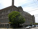
Communications Technology High School was a public high school serving grades 9–12 located at 8110 Lyons Avenue in the Hedgerow neighborhood of Philadelphia, Pennsylvania. The school, which was located next to George Pepper Middle School, was part of the School District of Philadelphia's Comprehensive High School Region; in its later years, it operated as a campus of John Bartram High School, which is still in operation. In 2013, amid the rapid growth of publicly-funded charter schools in Philadelphia, the City shut down Communications Technology High School, along with 22 other district-run schools, to cut costs and consolidate the district's remaining students on fewer campuses. Students enrolled at Communications Technology at the time were automatically re-enrolled at the main campus of John Bartram High School.

Excerpt from the Wikipedia article Communications Technology High School (License: CC BY-SA 3.0, Authors, Images).

Communications Technology High School
Lyons Avenue, Philadelphia

Geographical coordinates (GPS) Address Nearby Places
placeShow on map

Wikipedia: Communications Technology High SchoolContinue reading on Wikipedia

Geographical coordinates (GPS)

Latitude Longitude
N 39.8986 ° E -75.246 °
placeShow on map

Address

Communications Technology High School

Lyons Avenue
19153 Philadelphia
Pennsylvania, United States
mapOpen on Google Maps

G Wolf School Philly
Share experience

Nearby Places

Eastwick station
Eastwick station

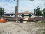
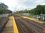
Eastwick station is a SEPTA Regional Rail station in Philadelphia. It serves the Airport Line to Philadelphia International Airport. Located below 84th Street and situated between Mario Lanza Boulevard and Bartram Avenue (PA 291), it is the sole stop between central Philadelphia and the Philadelphia International Airport Terminals. Eastwick is within walking distance of the Eastwick Loop station of the 36 trolley which is located at Island Avenue and 80th Street. In 2013, this station saw 367 boardings and 421 alightings on an average weekday. The station is accessed from Interstate 95 northbound via exit 10 and southbound via exit 12B. Access to the station is granted via a cul-de-sac off of Bartram Avenue and also from Mario Lanza Boulevard. Pedestrians and drivers coming from 84th Street must use either Crane Street to Lanza Boulevard or 84th to south on Bartram. While the station has no official SEPTA parking lot, a number of parking spaces along Mario Lanza Boulevard and Crane Street are used by commuters patronizing the stop. Eastwick station, located along the original Philadelphia, Wilmington and Baltimore Railroad main line, was conceived as 84th Street, under which name (as "proposed") it appeared on 1984 SEPTA informational maps. The present minimalist station was erected in 1997 in order to serve newly built local office parks as quickly as possible. SEPTA, along with the City of Philadelphia, plans to expand the station, transforming it into the Eastwick Transportation Center.When the station opened, it was a Zone 2 station. On July 1, 2013, SEPTA changed Eastwick to a Zone 1 station in conjunction with a fare increase and zone realignment. On the same day, the airport stations changed from Zone 5 to Zone 4.

Southwest Philadelphia

Southwest Philadelphia (formerly Kingsessing Township) is a section of Philadelphia, Pennsylvania, United States. The section can be described as extending from the western side of the Schuylkill River to the city line, with the SEPTA. The northern border is defined by the Philadelphia City Planning Commission as east from the city line along Baltimore Avenue moving south along 51st Street to Springfield Ave. It follows the train tracks until 49th Street. From 49th and Kingsessing Ave the line moves east along Kingsessing Ave. The line then moves south along 46th St to Paschall Ave where it jogs to join Grays Ferry where the line runs to the Schuylkill River.Southwest Philadelphia is also described by the city as being the area south of Baltimore Avenue; at the turn of the 20th century, Baltimore Avenue between 49th and 52nd Streets was known as "The Hub of Southwest Philadelphia" . Historically home to many Irish American neighborhoods, the section now has a large African American and West African immigrant population; a recent nickname is "Little Africa".Southwest Philadelphia contains Philadelphia International Airport, oil refineries, and other heavy industries. The housing stock is diverse with ornate Queen Anne-style twin mansions in the neighborhoods bordering Cedar Park, plainer and simpler styles of twins predominating closer to the airport, and newer rowhouses, many with porches, filling in many neighborhoods. Less than 1% of Southwest is covered by trees, giving it one of the lowest ratios of shade tree cover in the city.The Philadelphia Police Department patrols the 12th and 77th districts within Southwest Philadelphia.

Elmwood Park, Philadelphia

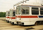
Elmwood Park, also known simply as Elmwood, is a neighborhood in the Southwest section of Philadelphia, Pennsylvania, United States. It borders the city line with Delaware County at Cobbs Creek, and extends to the Schuylkill River. The Eastwick neighborhood borders it to the southwest, and Kingsessing borders it on the northeast. Poles and Irish Americans had long been the majority in the neighborhood, organized around Catholic parishes established throughout the early to mid 20th century. In 1985, Mayor Wilson Goode declared a state of emergency as white rioters demonstrated outside two houses in Elmwood, creating an "imminent danger of civil disturbance." One home had been sold to an African-American family and the other to an interracial couple. Between 1990 and 2000, the white population decreased by 57.39% while the African American population increased by 55.40%. Vietnamese American refugees and West African immigrants have joined African Americans in making today's Elmwood a more racially diverse neighborhood as the white population decreases. The Route 36 trolley runs along Elmwood Avenue through the heart of the neighborhood. A storage facility that is also used as an alternate terminus is also located there. The Thomas Buchanan Read School was added to the National Register of Historic Places in 1986.Elmwood Park's The Labor Monument: Philadelphia's Tribute to the American Worker (2010) by artist John Kindness is one of the first monuments in the United States commemorating the contributions of organized labor nationwide. The monument was commissioned by the Association for Public Art (formerly the Fairmount Park Art Association) and installed in 2010 at 71st Street and Buist Avenue.