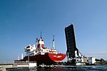
Capture of the Caen canal and Orne river bridges

The capture of the Caen canal and Orne river bridges (wrongly known as Operation Deadstick (which in fact was a specialized glider exercise), and in official documents as Operation Coup de Main) was an operation by airborne forces of the British Army that took place in the early hours of 6 June 1944 as part of the Normandy landings of the Second World War. The objective was to capture intact two road bridges in Normandy across the River Orne and the Caen canal, providing the only exit eastwards for British forces from their landing on Sword Beach. Intelligence reports said both bridges were heavily defended by the Germans and wired for demolition. Once captured, the bridges had to be held against any counter-attack, until the assault force was relieved by commandos and other infantry advancing from the landing beach. The mission was vital to the success of Operation Tonga, the overall British airborne landings in Normandy. Failure to capture the bridges intact, or to prevent their demolition by the Germans, would leave the British 6th Airborne Division cut off from the rest of the Allied armies with their backs to the two waterways. If the Germans retained control over the bridges, they could be used by their armoured divisions to attack the landing beaches of Normandy. Responsibility for the operation was assigned to the members of 'D' Company, 2nd (Airborne) Battalion, Oxfordshire and Buckinghamshire Light Infantry, part of the 6th Airlanding Brigade, 6th Airborne Division. The assault group comprised a reinforced company of six infantry platoons and an attached platoon of Royal Engineers. The British assault group flew from the south of England to Normandy in six Airspeed Horsa gliders. The pilots of the gliders succeeded in delivering the company to its objective. After a brief exchange of fire, both bridges were captured and defended successfully against German tank, gunboat and infantry counter-attacks, until relief arrived.
Excerpt from the Wikipedia article Capture of the Caen canal and Orne river bridges (License: CC BY-SA 3.0, Authors, Images).Capture of the Caen canal and Orne river bridges
Esplanade Major John Howard, Caen
Geographical coordinates (GPS) Address Nearby Places Show on map
Geographical coordinates (GPS)
| Latitude | Longitude |
|---|---|
| N 49.242222222222 ° | E -0.27444444444444 ° |
Address
Pegasus Bridge
Esplanade Major John Howard
14970 Caen
Normandy, France
Open on Google Maps


