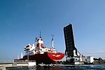
Horsa Bridge
British airborne landings in NormandyBuildings and structures in Calvados (department)World War II sites in France

Horsa Bridge, also known as Ranville Bridge, over the Orne river, was, along with Pegasus Bridge, captured during Operation Tonga by gliderborne troops of the 2nd Oxfordshire and Buckinghamshire Light Infantry (the 52nd) in a coup de main operation in the opening minutes of D-Day, 6 June 1944. The seizing of both bridges was considered to be critical to securing the eastern flank of the Normandy landings area, preventing German armour from reaching the British 3rd Infantry Division which was due to start landing on Sword at 07.25hrs. Horsa Bridge, a road bridge, was over 400 yards east of Pegasus Bridge towards the village of Ranville.
Excerpt from the Wikipedia article Horsa Bridge (License: CC BY-SA 3.0, Authors, Images).Horsa Bridge
D 514, Lisieux
Geographical coordinates (GPS) Address External links Nearby Places Show on map
Geographical coordinates (GPS)
| Latitude | Longitude |
|---|---|
| N 49.240277777778 ° | E -0.26666666666667 ° |
Address
Pont de Ranville (Horsa bridge)
D 514
14860 Lisieux
Normandy, France
Open on Google Maps


