place

Ffynnon Beuno and Cae Gwyn Caves

Scheduled monuments in DenbighshireSites of Special Scientific Interest in ClwydTremeirchionUnited Kingdom Site of Special Scientific Interest stubsUse British English from July 2022
Water wells in Wales
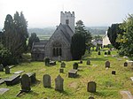
Ffynnon Beuno Cave, Tremeirchion geograph.org.uk 627574

Ffynnon Beuno and Cae Gwyn Caves are two Scheduled Ancient Monuments, in Denbighshire, Wales, which are also designated a Site of Special Scientific Interest (SSSI). The site has two caves, with entrances close to each other high on a valley side, above the Vale of Clwyd. They were first excavated in 1883–5. Human tools have been found on the site dating back to around 36,000 BC, and a mammoth bone has been dated back to 16,000 BC. These very early discoveries were significant in providing one of the first direct associations between stone tools of paleolithic people and the bones of extinct pre-iceage animals such as mammoth and woolly rhinoceros.In 1963 it was designated as an SSSI for the palaeontological interest described above and for its species interest as a winter roost of lesser horseshoe bat.

Excerpt from the Wikipedia article Ffynnon Beuno and Cae Gwyn Caves (License: CC BY-SA 3.0, Authors, Images).

Ffynnon Beuno and Cae Gwyn Caves
B5429,

Geographical coordinates (GPS) Address Nearby Places
placeShow on map

Wikipedia: Ffynnon Beuno and Cae Gwyn CavesContinue reading on Wikipedia

Geographical coordinates (GPS)

Latitude Longitude
N 53.241 ° E -3.3719 °
placeShow on map

Address

Ffynnon Beuno Cave

B5429
LL16 4EN , Tremeirchion
Wales, United Kingdom
mapOpen on Google Maps

Ffynnon Beuno Cave, Tremeirchion geograph.org.uk 627574
Share experience

Nearby Places

Moel y Gaer, Bodfari

Moel y Gaer (Welsh for "bald hill of the fortress") is an Iron Age hillfort at the northern end of the Clwydian Range, located on a summit overlooking the valley of the River Wheeler, near the village of Bodfari, Denbighshire, Wales, five miles north-east of Denbigh. The site is a scheduled monument, classified as a prehistoric defensive hillfort.The hillfort is one of a chain of six hillforts in the Clwydian Range, which are, from north to south, Moel Hiraddug, Moel y Gaer Bodfari, Penycloddiau, Moel Arthur, Moel y Gaer Llanbedr, and Moel Fenlli. Moel y Gaer Bodfari is the lowest of these hillforts, being just 200 m (656 ft) above sea level. The hill on which it stands is surrounded by lower land and is strategically situated at the confluence of the River Wheeler and the Clwyd. Offa's Dyke Path passes along the foot of the hill. The fort at Moel y Gaer is one of the smallest of the chain of defensive works found along the Clwydians. It probably dates from the Iron Age, although there is no definitive evidence to establish the exact period during which it was occupied. It has a single entrance on its northern side and is defended by a steep slope on the eastern side of the hill.Excavation started in 2011 and is ongoing as of 2016. The area enclosed by the ramparts is about two hectares. Various anomalies have been targeted in the excavations, including what is possibly a group of pits and other features where the ground seems to have been dug out, as well as what seems to be a roundhouse on a levelled piece of land. Examination of the middle rampart began in 2013, and it seems that there may have been several phases in its construction.