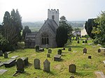
Vale of Clwyd
The Vale of Clwyd (Welsh: Dyffryn Clwyd) is a tract of low-lying ground in the county of Denbighshire in north-east Wales. The Vale extends south-southwestwards from the coast of the Irish Sea for some 20 miles (about 30 km) forming a triangle of low ground bounded on its eastern side by the well-defined scarp of the Clwydian Range and to the west by numerous low hills. The River Clwyd (Welsh: Afon Clwyd) which rises within Clocaenog Forest, southwest of Denbigh, runs the full length of the vale. It is joined by the two major left bank tributaries of the River Clywedog (Welsh: Afon Clywedog) and River Elwy (Welsh: Afon Elwy) and the smaller right bank tributary of the River Wheeler (Welsh: Afon Chwiler).
Excerpt from the Wikipedia article Vale of Clwyd (License: CC BY-SA 3.0, Authors).Vale of Clwyd
A543,
Geographical coordinates (GPS) Address Nearby Places Show on map
Geographical coordinates (GPS)
| Latitude | Longitude |
|---|---|
| N 53.21 ° | E -3.38 ° |
Address
Lleweni Parc Glyndwr Soaring Club
A543
LL16 4BN , Denbigh
Wales, United Kingdom
Open on Google Maps


