place

Allerthorpe

Civil parishes in the East Riding of YorkshireOpenDomesdayUse British English from October 2014Villages in the East Riding of Yorkshire
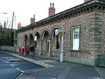
The Plough Inn geograph.org.uk 1407811

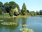
Allerthorpe is a village and civil parish in the East Riding of Yorkshire, England. It is situated approximately 1.5 miles (2.4 km) south-west from the town of Pocklington. The civil parish is formed by the village of Allerthorpe and the hamlet of Waplington. According to the 2011 UK census, Allerthorpe parish had a population of 220, a slight reduction from the 2001 UK census figure of 223. The parish covers an area of 969.217 hectares (2,394.99 acres). Allerthorpe has a public house, The Plough Inn, an 18-hole golf course and a lake used for water sports and fishing. Allerthorpe Common, to the west of the village, has a nature reserve. Allerthorpe's Victorian Grade II listed Anglican parish church is dedicated to St Botolph.From the mediaeval era until the 19th century Allerthorpe was part of Harthill Wapentake. Between 1894 and 1974 it was a part of the Pocklington Rural District, in the East Riding of Yorkshire. Between 1974 and 1996 it was part of the Borough of North Wolds (later Borough of East Yorkshire), in the county of Humberside.The K6 telephone box on Main Street is Grade II listed.Thomas Cooke, the machinist and optical instrument maker, was born here. There is a memorial stone to him near the church gate and a blue plaque was unveiled in the village hall in 2009.William Dewsbury the Quaker minister was born in the village.

Excerpt from the Wikipedia article Allerthorpe (License: CC BY-SA 3.0, Authors, Images).

Allerthorpe
Main Street,

Geographical coordinates (GPS) Address Nearby Places
placeShow on map

Wikipedia: AllerthorpeContinue reading on Wikipedia

Geographical coordinates (GPS)

Latitude Longitude
N 53.916821 ° E -0.80768 °
placeShow on map

Address

Main Street

Main Street
YO42 4RW , Allerthorpe
England, United Kingdom
mapOpen on Google Maps

The Plough Inn geograph.org.uk 1407811
Share experience

Nearby Places

Bielby
Bielby

Bielby is a village and civil parish in the East Riding of Yorkshire, England. The village is situated about 4 miles (6.4 km) south of Pocklington. According to the 2011 UK census, Bielby parish had a population of 258, a decrease on the 2001 UK census figure of 281.About two miles north-east of Bielby, on the edge of Hayton, lie the ruins of an ancient Roman military fortress, an important archaeological site. The University of Durham, Dept of Archaeology, led an excavation between 1995 and 1998 with assistance from local residents and University of Leeds students. A well, a bath-house and many other parts of the Roman fortress have been identified. The name Bielby, spelled Belebi in the Domesday Book, derives from the Old Scandinavian personal name Beli, and means "farmstead or village of a man called Beli." The total rent collected from tenants in Bielby dropped from 1066 to 1086 from £56 to £8. By the 11th century Bielebi (Bielby) had almost 10 residents. One home in Bielby is proudly named Bielbyville. Most homes in Bielby have a name plate sign displayed either on the front exterior wall or in the yard (even though the homes are modest in size). Another House at the end of the village is Manor Cottage where many a farmers worked on land next to the house (although since 2009 been empty). Bielby has an Anglican church (St. Giles), which dates back more than 900 years. The Methodist revival which swept England in the 18th century still has a visible presence in Bielby, although the old Methodist Church building in the village is now a private residence.