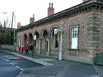
Barmby Moor

Barmby Moor is a village and civil parish in the East Riding of Yorkshire, England. It is situated approximately 1.5 miles (2.4 km) west of the market town of Pocklington and 12.5 miles (20 km) east-southeast of the city of York. It lies north of the A1079 road where it is met by the B1246 road that passes through the village. According to the 2011 UK census, Barmby Moor parish had a population of 1,114, an increase on the 2001 UK census figure of 1,065.The village was originally a market town with a coaching inn. It has a church, dedicated to St Catherine, chapel, village hall and a primary school. There is also a post office and a pub, The Boot & Slipper. The church and the Manor House were designated as Grade II* listed buildings in 1967 and are now recorded in the National Heritage List for England, maintained by Historic England.Each July a traditional fete – the Barmby Feast – is held in the village.
Excerpt from the Wikipedia article Barmby Moor (License: CC BY-SA 3.0, Authors, Images).Barmby Moor
Main Street,
Geographical coordinates (GPS) Address Nearby Places Show on map
Geographical coordinates (GPS)
| Latitude | Longitude |
|---|---|
| N 53.930522 ° | E -0.817996 ° |
Address
Main Street
YO42 4EE , Barmby Moor
England, United Kingdom
Open on Google Maps


