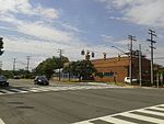
Holmes Run Trail

The Holmes Run Trail is a partially paved trail that travels through parks northwest along Holmes Run from Cameron Run in Alexandria, Virginia to Annandale Road (Virginia State Route 649) in Fairfax County, Virginia. The trail travels near the sides of the stream with multiple bridges, some of which are only about a foot higher than the water. The trail consists of two sections that are separated by Lake Barcroft near Columbia Pike (Virginia State Route 244) in Fairfax County. The Alexandria portion of the trail is 2.6 miles (4.2 km) in length and travels northwest in Alexandria from Eisenhower Avenue at Cameron Run, next to Cameron Run Regional Park, to the Alexandria/Fairfax County boundary near the end of North Chambliss Street. The Fairfax County portion of the trail travels northwest between that boundary and Columbia Pike and is 1.2 miles (1.9 km) in length. A bridge over the Run in Alexandria that is located a short distance southeast of the boundary and Fairfax County's Glen Hills Park connects these two portions of the trail, which together comprise the trail's entire 3.8-mile-long (6.1 km) southern section. The northern section of the trail is 1.2 miles (1.9 km) in length and located entirely in Fairfax County. It has an asphalt surface in some places and a stonedust surface in others.
Excerpt from the Wikipedia article Holmes Run Trail (License: CC BY-SA 3.0, Authors, Images).Holmes Run Trail
Holmes Run Trail, Alexandria
Geographical coordinates (GPS) Address Nearby Places Show on map
Geographical coordinates (GPS)
| Latitude | Longitude |
|---|---|
| N 38.817846 ° | E -77.123928 ° |
Address
Holmes Run Trail
Holmes Run Trail
22304 Alexandria
Virginia, United States
Open on Google Maps


