Stemweder Berg
Forests and woodlands of North Rhine-WestphaliaHill ranges of GermanyStemwede

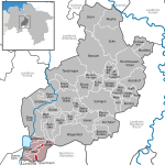
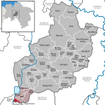
The Stemweder Berg (also known as the Stemmer Berge) is a ridge 181.4 metres (595 ft) above sea level on the border of North Rhine-Westphalia and Lower Saxony in Germany. It is the northernmost and smallest of Germany's Central Uplands ranges. Like the adjacent municipality of Stemwede, the ridge gets its name from the medieval Free County (Freigrafschaft) of Stemwede.
Excerpt from the Wikipedia article Stemweder Berg (License: CC BY-SA 3.0, Authors, Images).Stemweder Berg
Weißer Weg, Stemwede
Geographical coordinates (GPS) Address Nearby Places Show on map
Geographical coordinates (GPS)
| Latitude | Longitude |
|---|---|
| N 52.44861 ° | E 8.43028 ° |
Address
Weißer Weg
32351 Stemwede, Wehdem
North Rhine-Westphalia, Germany
Open on Google Maps


