place

Awkley

South Gloucestershire District geography stubsUse British English from July 2015Villages in South Gloucestershire District
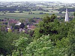
The Vine, Awkley geograph.org.uk 381044

Awkley is a hamlet in the parish of Olveston in South Gloucestershire, England. It lies just off the M4 and M48 junctions. Several streams run in the area including Tockington Mill Rhine, Moor Rhine, Niatt Rhine and Sandy Rhine. One notable building at Awkley is the former Ebenezer chapel, dated to 1850. Now known as "The Vine", it reopened for worship in August 2006.A will dated 1632 showed that the hamlet (known as "Awklers"), was owned by a William Tovy, who held it in socage from the manor of Tockington. He left it to his son and heir, Edward Tovy.

Excerpt from the Wikipedia article Awkley (License: CC BY-SA 3.0, Authors, Images).

Geographical coordinates (GPS)

Latitude Longitude
N 51.569721 ° E -2.586637 °
placeShow on map

Address

Awkley Lane

Awkley Lane
BS32 4LP , Olveston
England, United Kingdom
mapOpen on Google Maps

The Vine, Awkley geograph.org.uk 381044
Share experience

Nearby Places

Over, South Gloucestershire

Over is a village in the civil parish of Almondsbury in South Gloucestershire, England, 6 miles (10 km) north of Bristol. It lies on the B4055, a road that parallels the M5 from Junction 17 to 16. The road, known locally as Over Lane, abuts to the east a ridge which overlooks the Severn floodplain, dominated by Bristol Golf Club or Course. According to local legends, a ghost of an old woman haunts this place every New Year's Eve.Over Court had a large deer park, which was largely replaced in the 20th century by the golf venue.A similar deer park was higher and to the north at Knole Park, the house of which was centred on a small knoll which was a fortified Roman camp. Most of its grounds have been replaced by a large brick quarry, Springwood Nurseries and Almondsbury's paired garden centres which are notable for large outdoor areas. Beyond the clustered settlement, before the lane climbs to the north it passes over the London to South Wales Main Line, a railway emerging from Patchway Tunnel before heading across the Severn floodplain to the Severn Tunnel. Its main station is Bristol Parkway station a few miles to the southeast. Via mainly rural, linear Easter Compton parish or footpaths and tiny lanes which follow the line closely Pilning railway station is a walk about 2 miles (3.2 km) away. The area is road-dominated and the loss of the deer parks has led to little tourism. In 2015 Pilning it was the sixth least used station in the UK — 68 passenger entries/exits were recorded for the year.