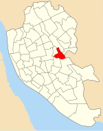
Broadgreen
Areas of LiverpoolMerseyside geography stubs

Broadgreen (officially Broad Green) is an eastern suburb of Liverpool, Merseyside, England. On the edge of the city, it is bordered by Old Swan to the north-west, Knotty Ash to the north-east, Childwall to the south and, further east, Bowring Park. Until 2004, it was a Liverpool City Council ward.
Excerpt from the Wikipedia article Broadgreen (License: CC BY-SA 3.0, Authors, Images).Broadgreen
Bowring Park Road, Liverpool Broad Green
Geographical coordinates (GPS) Address Nearby Places Show on map
Geographical coordinates (GPS)
| Latitude | Longitude |
|---|---|
| N 53.4062 ° | E -2.8965 ° |
Address
The Rocket
Bowring Park Road
L14 3AB Liverpool, Broad Green
England, United Kingdom
Open on Google Maps


