place

Shrewsbury College

Further education colleges in ShropshireSchools in ShrewsburyUse British English from February 2023

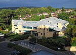
Shrewsbury College is a further education college in Shrewsbury, Shropshire, England. Previously called Shrewsbury College of Arts and Technology and, earlier, Shrewsbury Technical College, the college is based on a campus on London Road. The College provides vocational courses across a range of disciplines and has working environments for students including a commercial restaurant, Origins, a commercial salon, Evolve, and a student zone including a new Student Learning Centre and The Hub. The College is the main provider of vocational education in the county and has a full range of full-time and part-time courses available in the full range of subject areas. In 2019, it was rated Inadequate by Ofsted.

Excerpt from the Wikipedia article Shrewsbury College (License: CC BY-SA 3.0, Authors).

Geographical coordinates (GPS)

Latitude Longitude
N 52.697 ° E -2.723 °
placeShow on map

Address

Shrewsbury Colleges Group - London Road Campus

Harries Way
SY2 6PR , Springfield
England, United Kingdom
mapOpen on Google Maps

Phone number

call+441743342342

linkWikiData (Q7503667)
linkOpenStreetMap (56124544)

Share experience

Nearby Places

Shrewsbury Business Park

The Shrewsbury Business Park is a commercial development on the outskirts of Shrewsbury, Shropshire (at Emstrey). Construction commenced in late 2001 on the 30-acre (120,000 m2), £25 million site, and is still ongoing. Almost 200,000-square-foot (19,000 m2) of business premises have been delivered, largely attributed to Phase One of the scheme. Over 1,000 people are based there.The idea was first promoted by local developer the Alaska Group, which entered into a partnership with Shropshire County Council. Mainly offices, the business park includes a Holiday Inn Express Hotel and a children's daycare centre. Plans exist for a cafe retail unit at the heart of the development. Alaska Group was founded in London in 1994 in a former fur factory known as the Alaska Works, where skins were imported from Alaska. The company has no other connection with Alaska, however it gave the Park several place names from that State. The main route through the Park, Sitka Drive, is named after the State tree of Alaska. Other names include Anchorage Avenue, Mt McKinley Building, Bering House and Juneau House. Located around 3 miles (5 km) south east of the town centre of Shrewsbury, Shropshire's county town, the business park lies on the junction of the A5 bypass and the B4380, near to Emstrey. The park's appeal is partly thanks to excellent transport links via the nearby M54 motorway to Telford, Wolverhampton and Birmingham, while being near to a fine medieval town and beautiful countryside. Other business park developments in and around the town include the Oxon Business Park to the West of the town centre and the Battlefield Enterprise Park to the North, and Abbey Lawn next to Shrewsbury Abbey, just across the Severn from the town centre.

A5112 road
A5112 road

The A5112 is a road in Shropshire, England that runs north–south through the town of Shrewsbury. It runs around the town centre, to the east, and acts as a quicker route through the town than going via the town centre. Starting north at Battlefield Island where it joins the A49 (52.7461°N 2.7182°W / 52.7461; -2.7182 (A5112 road (northern end))), it consists of Battlefield Road, Whitchurch Road, Telford Way, Robertsford Way, Bage Way, Pritchard Way, Hazeldine Way and Hereford Road. The junctions along it are Battlefield Roundabout, Battlefield Road Crossroads, Harlescott Crossroads, Heathgates Roundabout, Telford Way Roundabout, Crowmere Roundabout, Rea Brook Roundabout, Sutton Park Roundabout, Meole Brace Island, Hereford Road Roundabout and Bayston Hill Roundabout where it rejoins the A49, as well as the A5 (52.6825°N 2.7586°W / 52.6825; -2.7586 (A5112 road (southern end))). The road has a speed limit of 50 mph (80 km/h) between Meole Brace Island and the Telford Way Roundabout with a 40 mph (64 km/h) speed limit between the Bayston Hill Roundabout and Meole Brace Island, and between the Telford Way Roundabout and the Heathgates Roundabout, and a 30 mph (48 km/h) speed limit for the remainder of the route. The road crosses the River Severn on Telford Way Bridge and is a safe route during flooding of the river. The road was for a short time in the late 1980s and early 1990s the A49, which now runs around a bypass of the town.