place

Belvidere School, Shrewsbury

Academies in ShropshireSchools in ShrewsburySecondary schools in ShropshireShropshire building and structure stubsUse British English from February 2023
West Midlands (region) school stubs

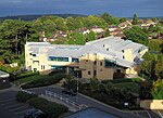
Belvidere School is a coeducational secondary school located in the Belvidere area of Shrewsbury, Shropshire, England. Belvidere draws 11- to 16-year-olds mainly from the surrounding areas of Monkmoor, Belvidere, Underdale, Abbey Foregate and Cherry Orchard. It is sited in grounds bordering open fields down to the River Severn. The school performs well in local school sport competitions. The school became a Technology College in 2003, specialising in Technology, Science and Mathematics. In 2008 it received a second speciality as a Training School.Previously a community school administered by Shropshire Council, in January 2019 Belvidere School converted to academy status. The school is now sponsored by the Central Shropshire Academy Trust.

Excerpt from the Wikipedia article Belvidere School, Shrewsbury (License: CC BY-SA 3.0, Authors).

Belvidere School, Shrewsbury
Crowmere Road,

Geographical coordinates (GPS) Address Phone number Website External links Nearby Places
placeShow on map

Wikipedia: Belvidere School, ShrewsburyContinue reading on Wikipedia

Geographical coordinates (GPS)

Latitude Longitude
N 52.71078 ° E -2.72082 °
placeShow on map

Address

Belvidere School

Crowmere Road
SY2 5LA , Belvidere
England, United Kingdom
mapOpen on Google Maps

Phone number

call+441743235073

Website
belvidere.shropshire.sch.uk

linkVisit website

linkWikiData (Q4884907)
linkOpenStreetMap (49369701)

Share experience

Nearby Places

A5112 road
A5112 road

The A5112 is a road in Shropshire, England that runs north–south through the town of Shrewsbury. It runs around the town centre, to the east, and acts as a quicker route through the town than going via the town centre. Starting north at Battlefield Island where it joins the A49 (52.7461°N 2.7182°W / 52.7461; -2.7182 (A5112 road (northern end))), it consists of Battlefield Road, Whitchurch Road, Telford Way, Robertsford Way, Bage Way, Pritchard Way, Hazeldine Way and Hereford Road. The junctions along it are Battlefield Roundabout, Battlefield Road Crossroads, Harlescott Crossroads, Heathgates Roundabout, Telford Way Roundabout, Crowmere Roundabout, Rea Brook Roundabout, Sutton Park Roundabout, Meole Brace Island, Hereford Road Roundabout and Bayston Hill Roundabout where it rejoins the A49, as well as the A5 (52.6825°N 2.7586°W / 52.6825; -2.7586 (A5112 road (southern end))). The road has a speed limit of 50 mph (80 km/h) between Meole Brace Island and the Telford Way Roundabout with a 40 mph (64 km/h) speed limit between the Bayston Hill Roundabout and Meole Brace Island, and between the Telford Way Roundabout and the Heathgates Roundabout, and a 30 mph (48 km/h) speed limit for the remainder of the route. The road crosses the River Severn on Telford Way Bridge and is a safe route during flooding of the river. The road was for a short time in the late 1980s and early 1990s the A49, which now runs around a bypass of the town.